Report chapters Overview
Cook Islands 2026
How living and raised reefs help us understand past sea levels across the Southern Cook Islands.
Initial field report · July 2026
Part of the HISEAS project Funded by the U.S. National Science Foundation (NSF)
Prepared for island leaders, schools, communities, project partners, and everyone who made the fieldwork possible.
- Islands
- 5
- Numbered sites
- 25
- Rock Samples
- 123
- Surface models
- 21
Field campaign
Reading old reefs for new insights
What remains uncertain
This is an initial report of our efforts, not a final sea-level history. Now we begin the meticulous process of trying to explain the observations in the context of geologic time, sea-level change, and past environmental conditions.
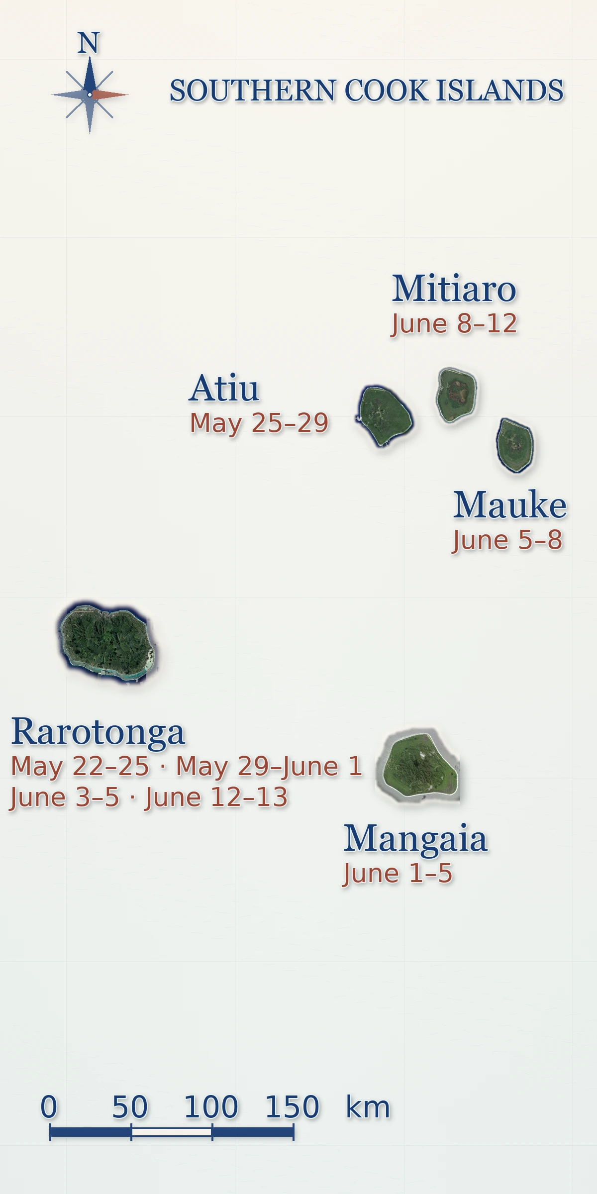
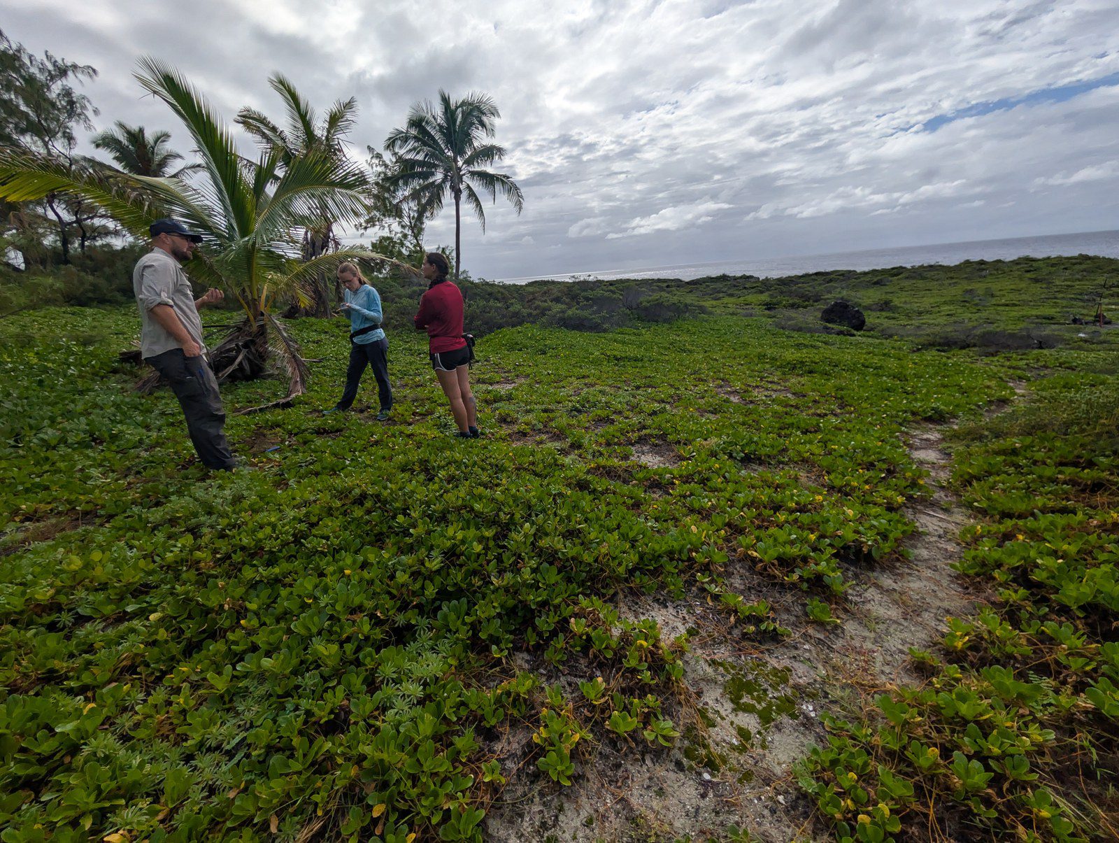
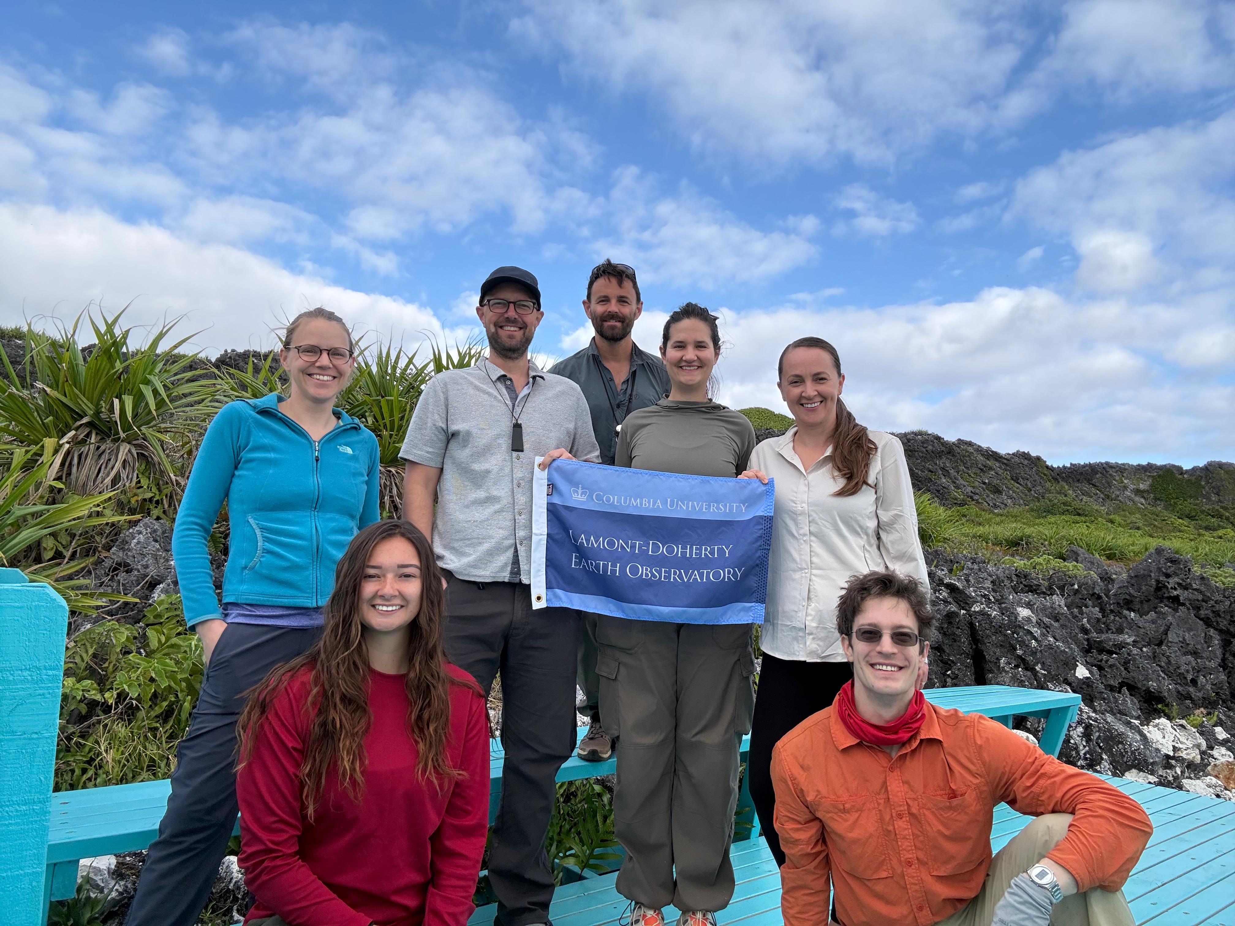
During May and June 2026, our team travelled to Rarotonga, Atiu, Mangaia, Mauke, and Mitiaro. Local leaders, teachers, students, guides, and residents helped us understand access, place names, coastal conditions, and the questions that matter locally.
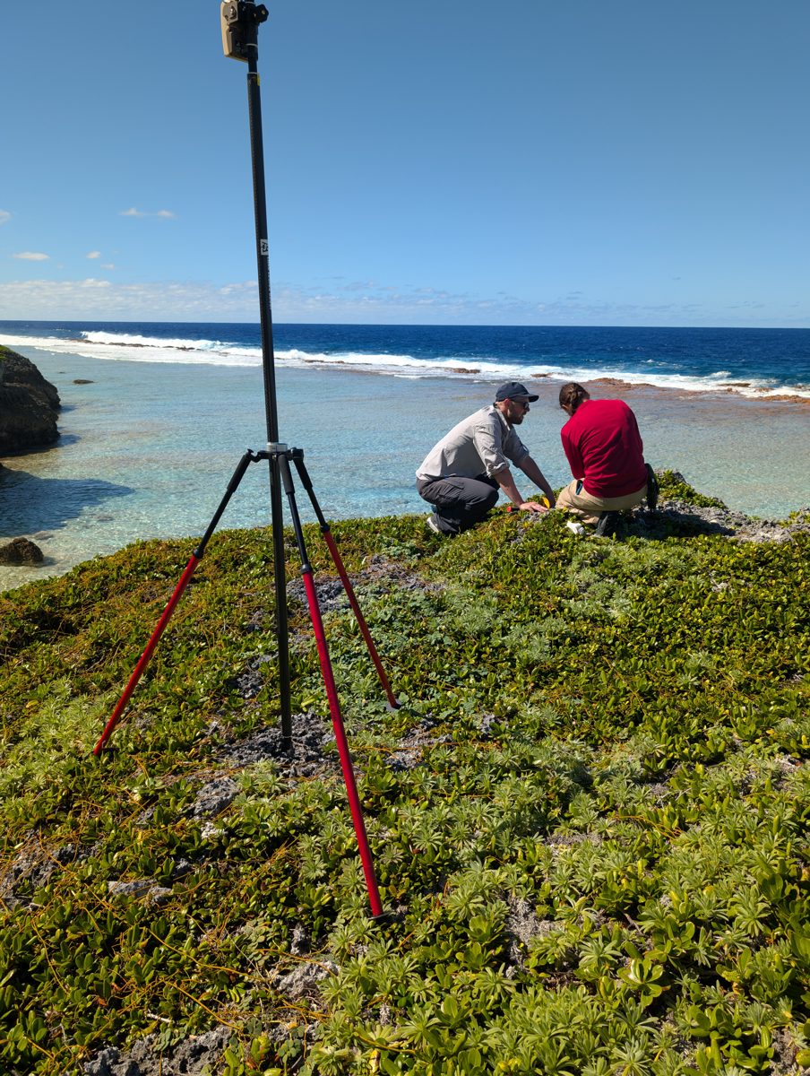
We studied living reef flats beside raised reef limestone (makatea), measured fossil corals and reef surfaces, installed temporary tide gauges, collected fossil coral samples, and mapped priority sites by drone. We want to understand why reefs that formed near sea level now occur at different heights and in different forms within and among islands.
Schools and community events
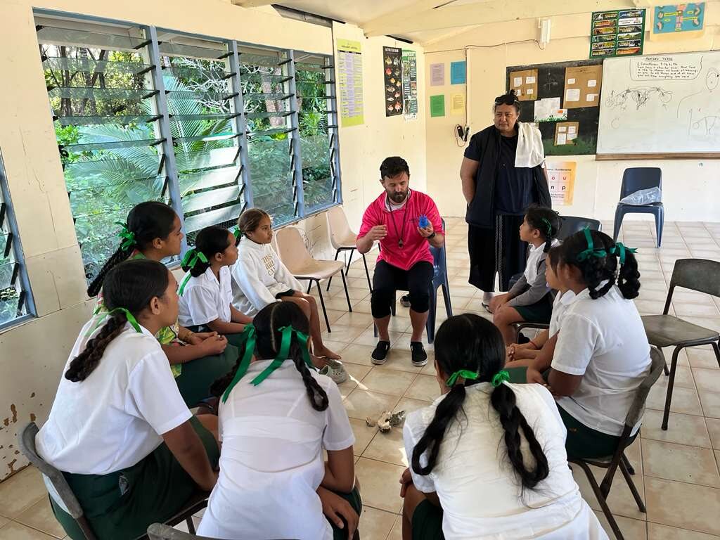
During the field trip, we visited schools on Rarotonga, Atiu, Mangaia, Mauke, and Mitiaro to explain how corals record environmental change and discuss the project with students and teachers. We also held a community event on Rarotonga.
The HISEAS Project
HISEAS investigates how much, and why, the Greenland and Antarctic ice sheets melted during the Last Interglacial—the most recent warmer period in Earth's history. This Cook Islands campaign contributes evidence preserved in the raised reefs of the Southern Cook Islands. Funded by the U.S. National Science Foundation (NSF), EAR 24-20482 (2024–2029).
Visit HISEAS.org-
01
Jacky Austermann
Associate Professor
Columbia University / Lamont-Doherty Earth Observatory
jackya@ldeo.columbia.edu -
02
Emalee Ott
M.S. Student
University of Florida
ott.emalee@ufl.edu -
03
William D’Andrea
Lamont Associate Research Professor
Columbia University / Lamont-Doherty Earth Observatory
dandrea@ldeo.columbia.edu -
04
Blake Dyer
Associate Professor
University of Victoria
blakedyer@uvic.ca -
05
Otillia Steadman
Graduate Student
Columbia University / Lamont-Doherty Earth Observatory
oms2128@columbia.edu -
06
Oana Dumitru
Assistant Professor
University of Florida
odumitru@ufl.edu -
07
Roger Creel
Assistant Professor
Texas A&M University
Roger.creel@tamu.edu
Field methods
One evidence chain, from reef to laboratory
Map
We recorded reef flats, benches, cliffs, and inland limestone with mapped GPS positions and documented field relationships.
Measure
Temporary tide gauges and GPS ties establish working island references for mean sea level. Feature heights are tied to those datums.
Model
Drone photographs are processed into detailed orthomosaics, elevation models, and 3D assets for 21 of the 25 numbered sites.
Collect
We catalogued 123 fossil coral and related samples whose position and height are precisely known, and geochemical preservation will be determined later.
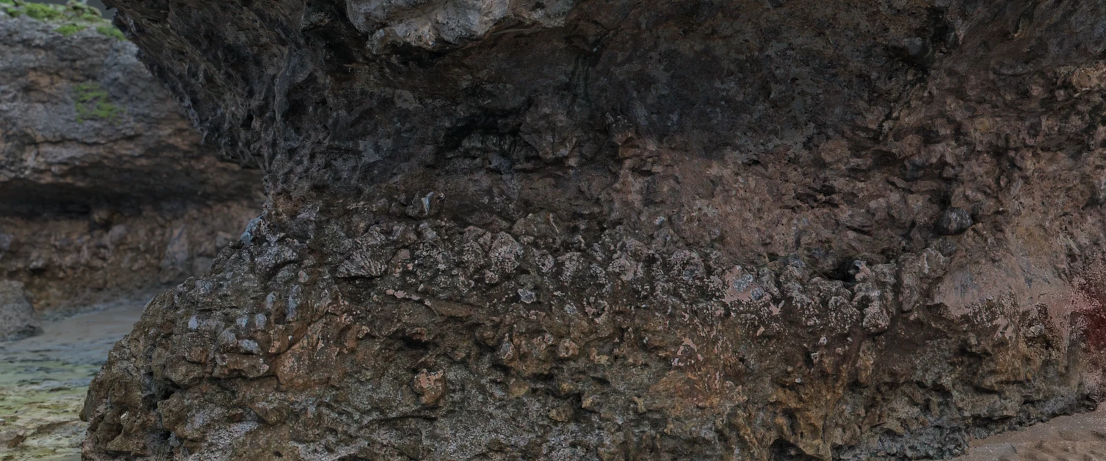
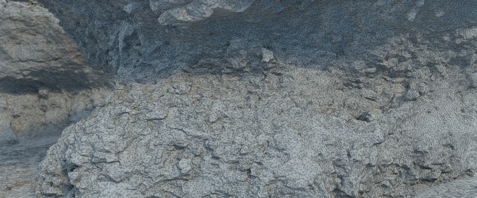
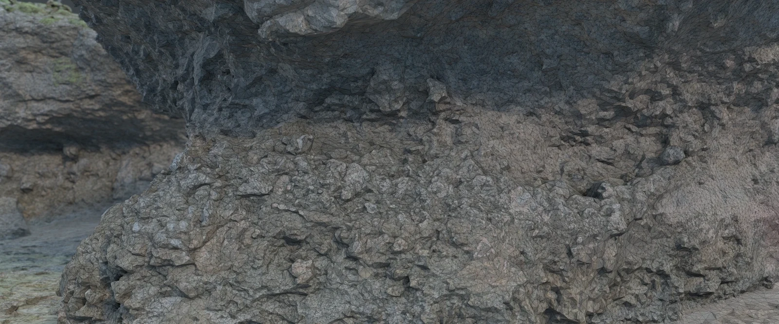 Drag left or right, or use the arrow keys, to move the boundary between the textured model and its matching wireframe.
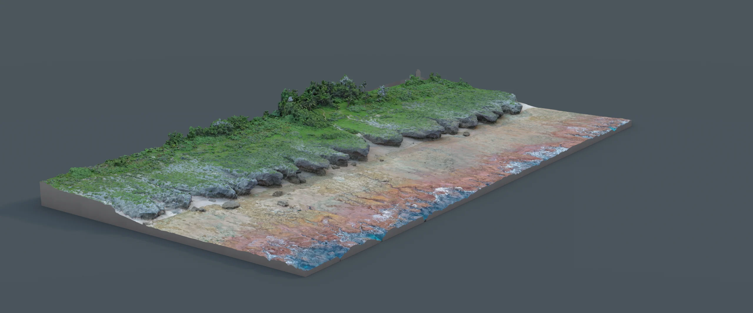
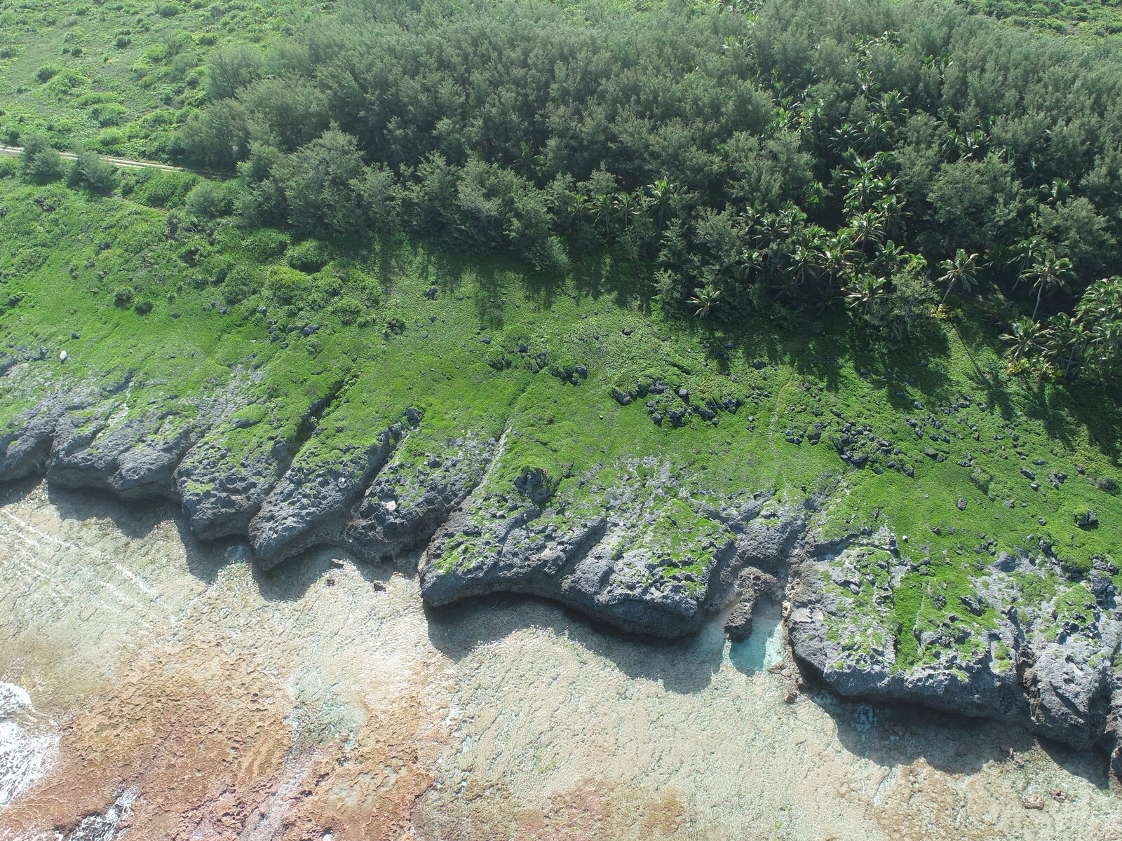
Overlapping drone photographs produced the site's orthomosaic, elevation model, and textured 3D surface. The overview and exact-frame texture-to-wireframe comparison show how the measured surface becomes a navigable 3D model, allowing us to continue to learn from the rocks at home.
Surveyed surface. An oblique view of the complete photogrammetric surface.
3D model. Texture and wireframe view of the cliff at Te Rotonui. Drag the midline in the web report to compare the photographic texture with the underlying triangular mesh; the print edition shows a left-right comparison.
Explore the complete HS123 survey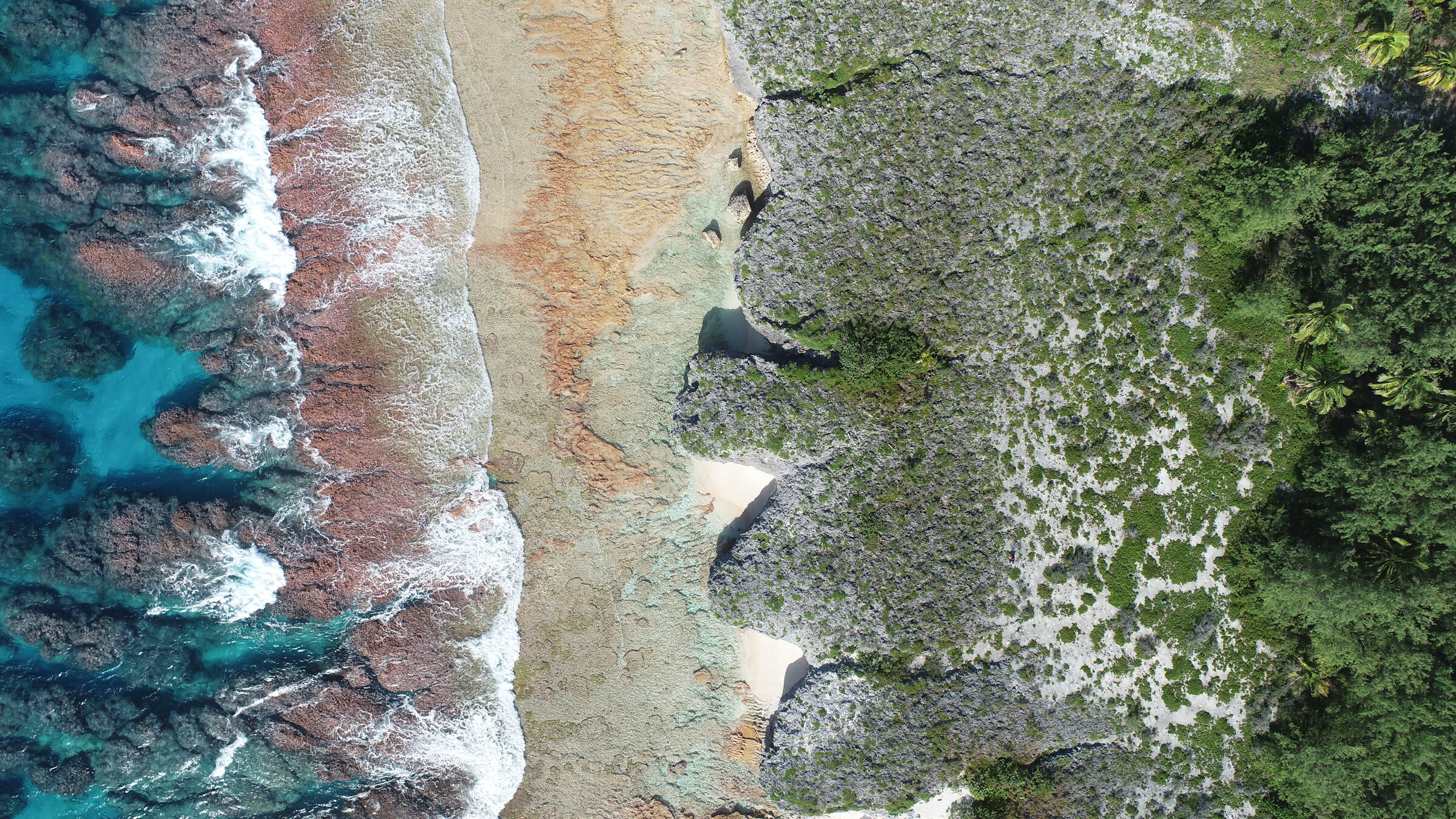
early Holocene notch
modern tidal notch
- Moana ‘o‘onu
- open ocean
- ‘Ātinga ngaru / Paringa ngaru
- reef crest
- Rōroka
- reef flat
- Akau
- back reef
- Pae tai
- beach
- Last Interglacial
- reef crest
- Last Interglacial
- reef flat
- Forested makatea
- raised fossil reef
Coastal transect
How a reef becomes makatea
A once living reef, preserved above the sea.
Makatea is limestone made by an older reef that grew close to sea level. During the Last Interglacial—a warm interval about 129,000 to 116,000 years ago—sea level was higher than today. Later changes in sea level, together with island uplift, left parts of that reef above the modern shore, where rain, waves, and vegetation reshaped it.
- Holocene
- the present geologic interval, covering the last 11,700 years
- Last Interglacial
- a warm interval about 129,000–116,000 years ago
The Holocene is the present geologic interval, spanning the last 11,700 years. Slightly raised coastal notches may record shorelines from within it, but their age must be tested rather than assumed.
-
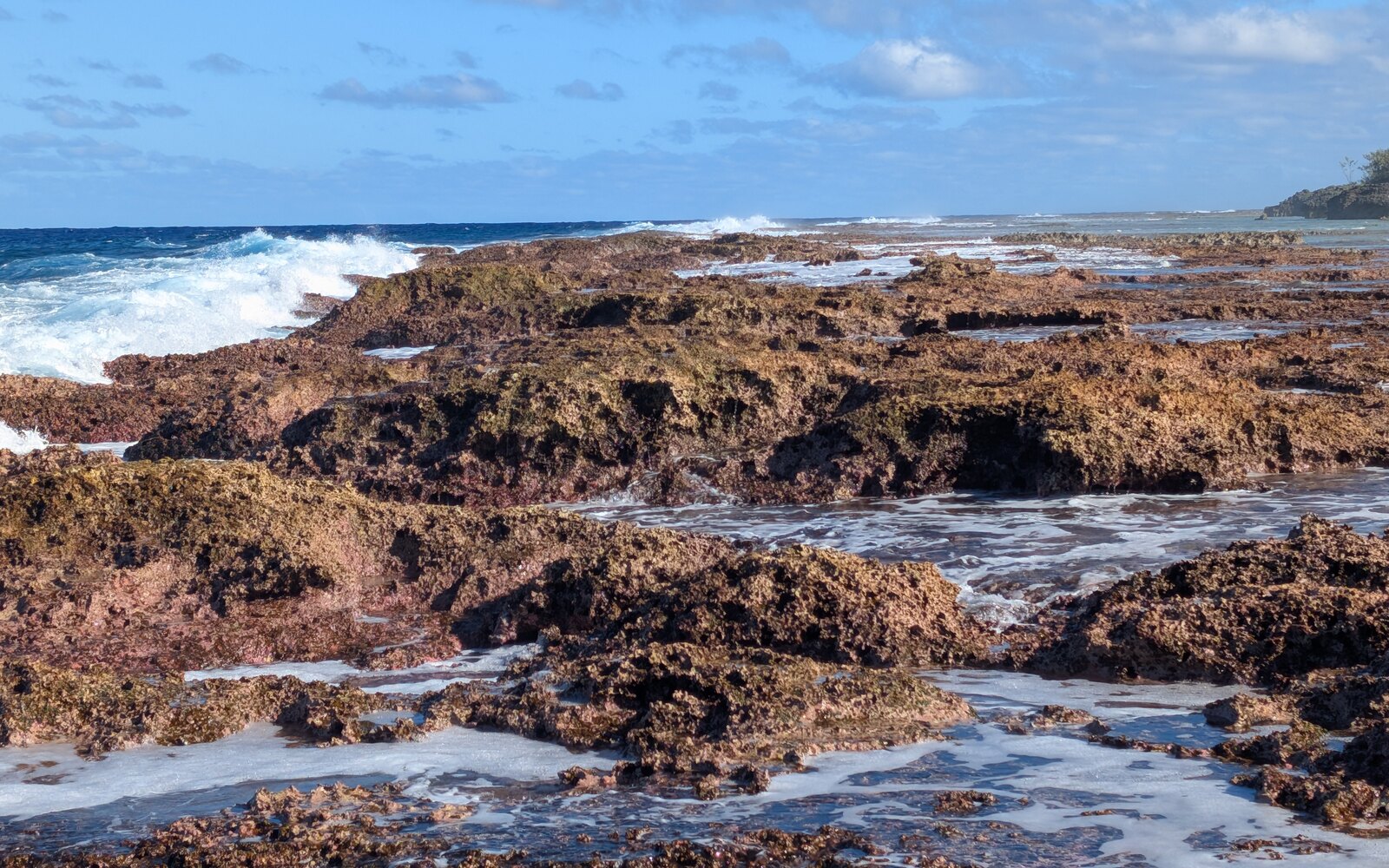
Modern reef crest (‘Ātinga ngaru / Paringa ngaru)
Waves wash across the flat at low tide, where calcareous crusts, algae, and other reef life build and bind the surface.
-

Living coral
Living corals build limestone skeletons that contribute to the framework of the modern reef.
-
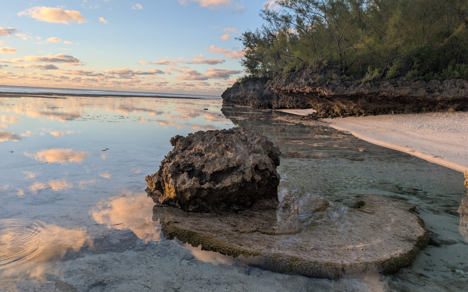
Beach and back reef (Pae tai · Akau)
Shallow back-reef water meets a pocket beach and corals grow outwards into micro-atolls, limited by the water level.
-
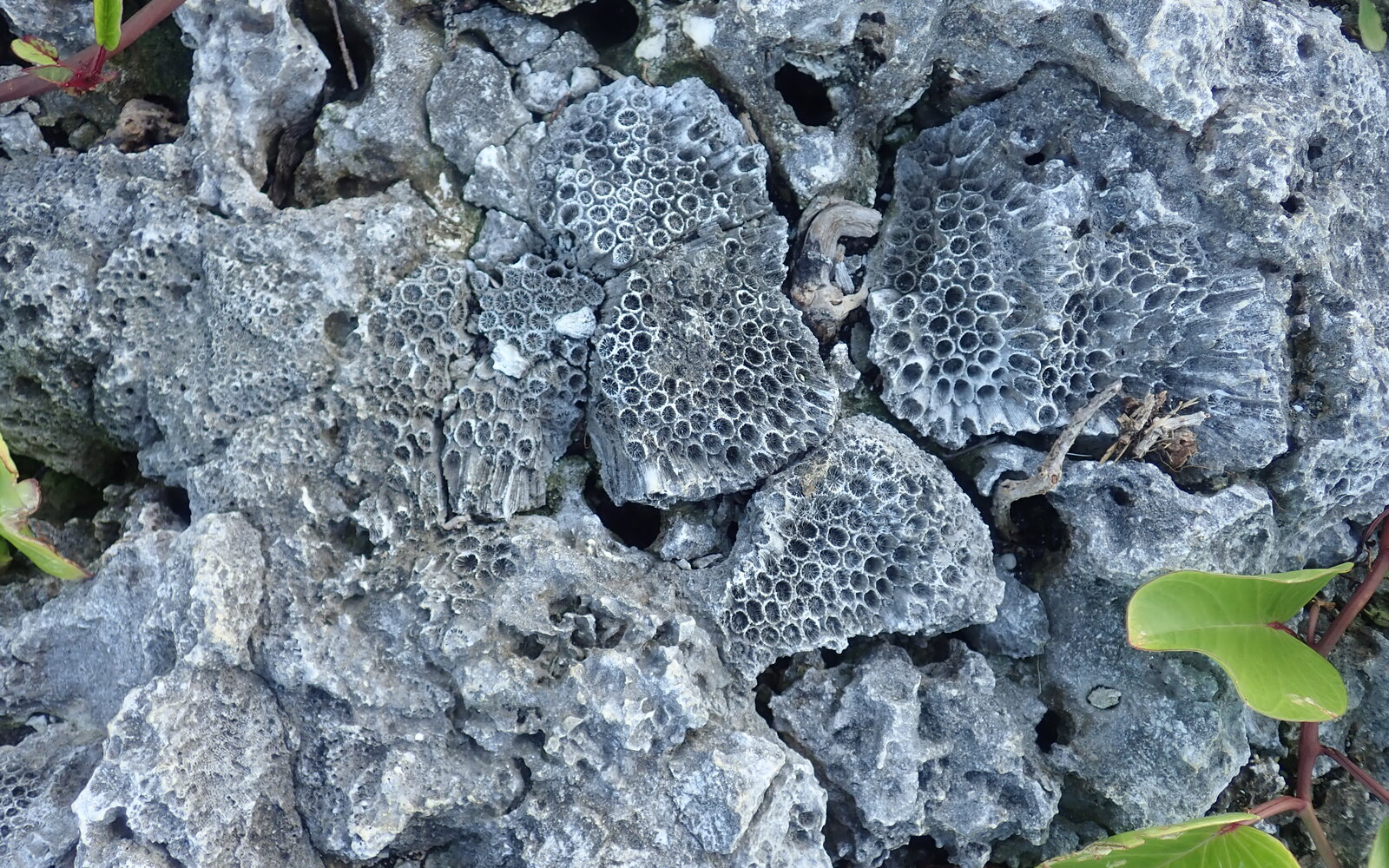
Fossil coral in makatea
Coral skeletons preserved in dry limestone show the biological origin of the raised reef.
Island 1 of 5
Rarotonga
Field records · May 31, 2026
Rarotonga was the expedition's arrival and coordination base and the setting for a school visit and community event, as well as an important comparison with the raised-reef islands. At Ngatangiia we investigated a coastal exposure of fossil coral reef. This site is but a small remnant of the island's former reef, and very distinct when compared to the raised reef (makatea) on the other Southern Cook Islands.
1 comparison locality 1 sample no surface model
1 comparison locality · 1 sample · no surface model
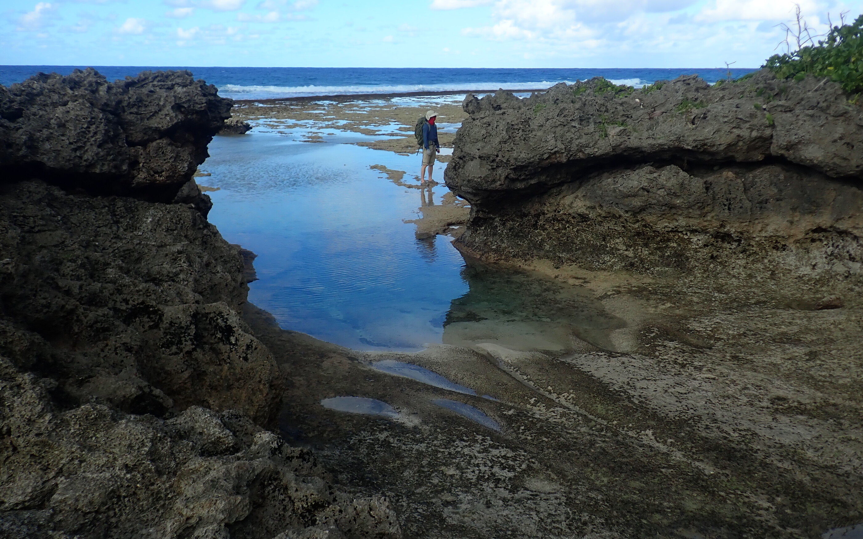
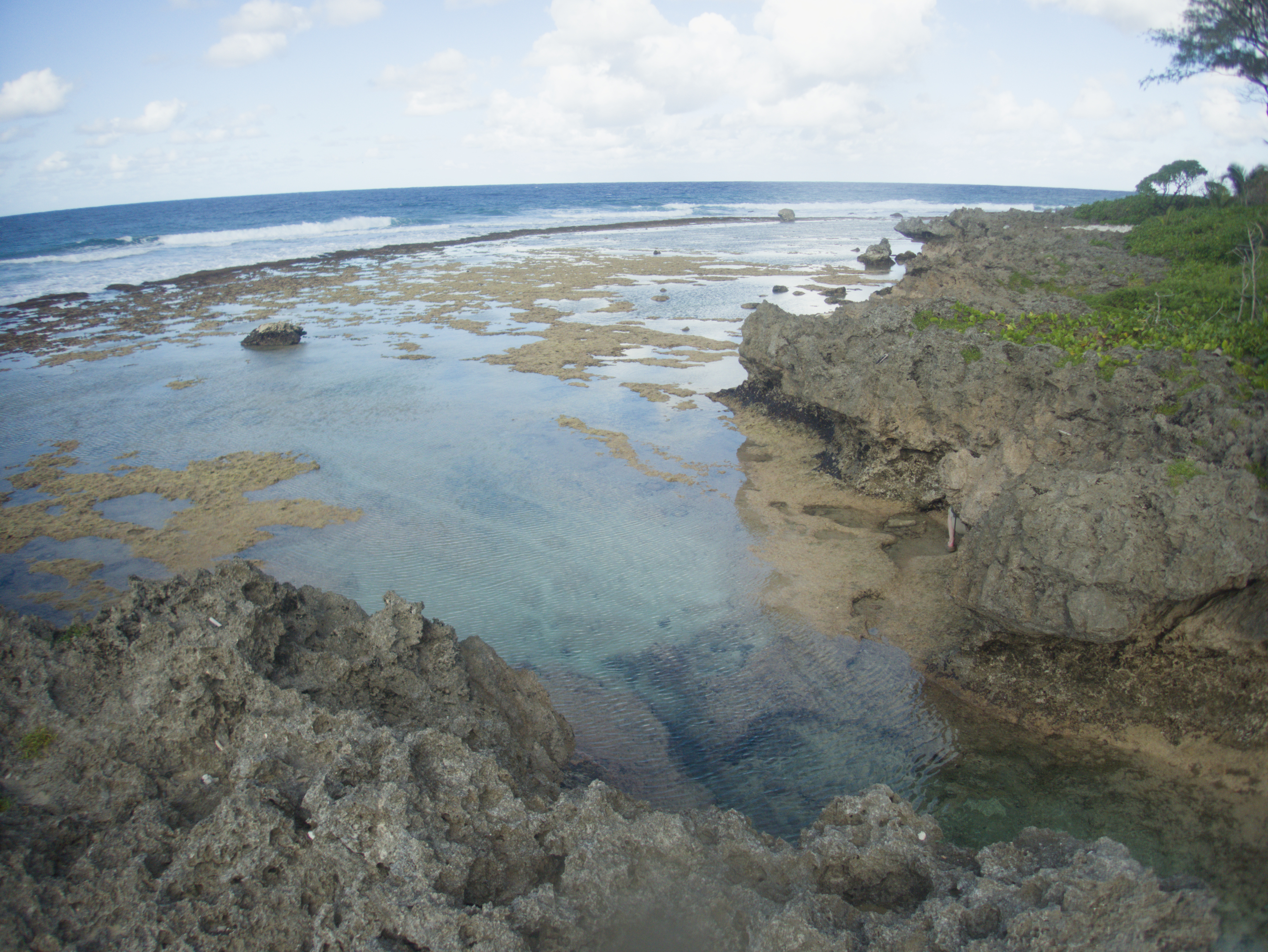
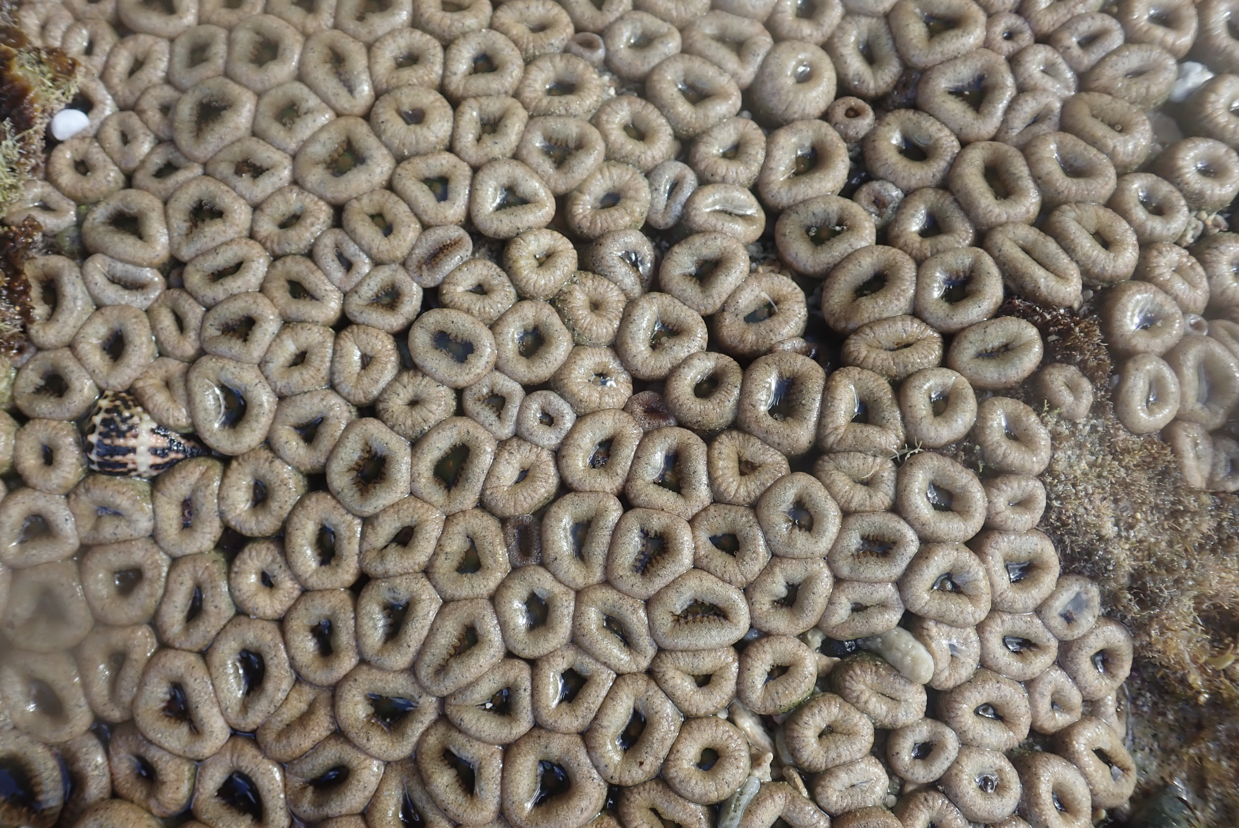
What the site showed
- Ngatangiia is a reference locality used in previously published Rarotonga work.
- Low tide exposed the modern reef flat and notch allowing study of the biological zonation of the modern coastline.
- The lower bench contains large encrusting corals and a surface built partly by algae.
- Living encrusting corals, algae, chitons, possible anemones, and worm or vermetid tubes document the modern biological zonation of the exposed reef edge.
- A perched boulder and wave-drainage channels record modern or storm-process overprints that are key parts of the modern reef expression.
Island 2 of 5
Atiu
Field records · May 25-29, 2026
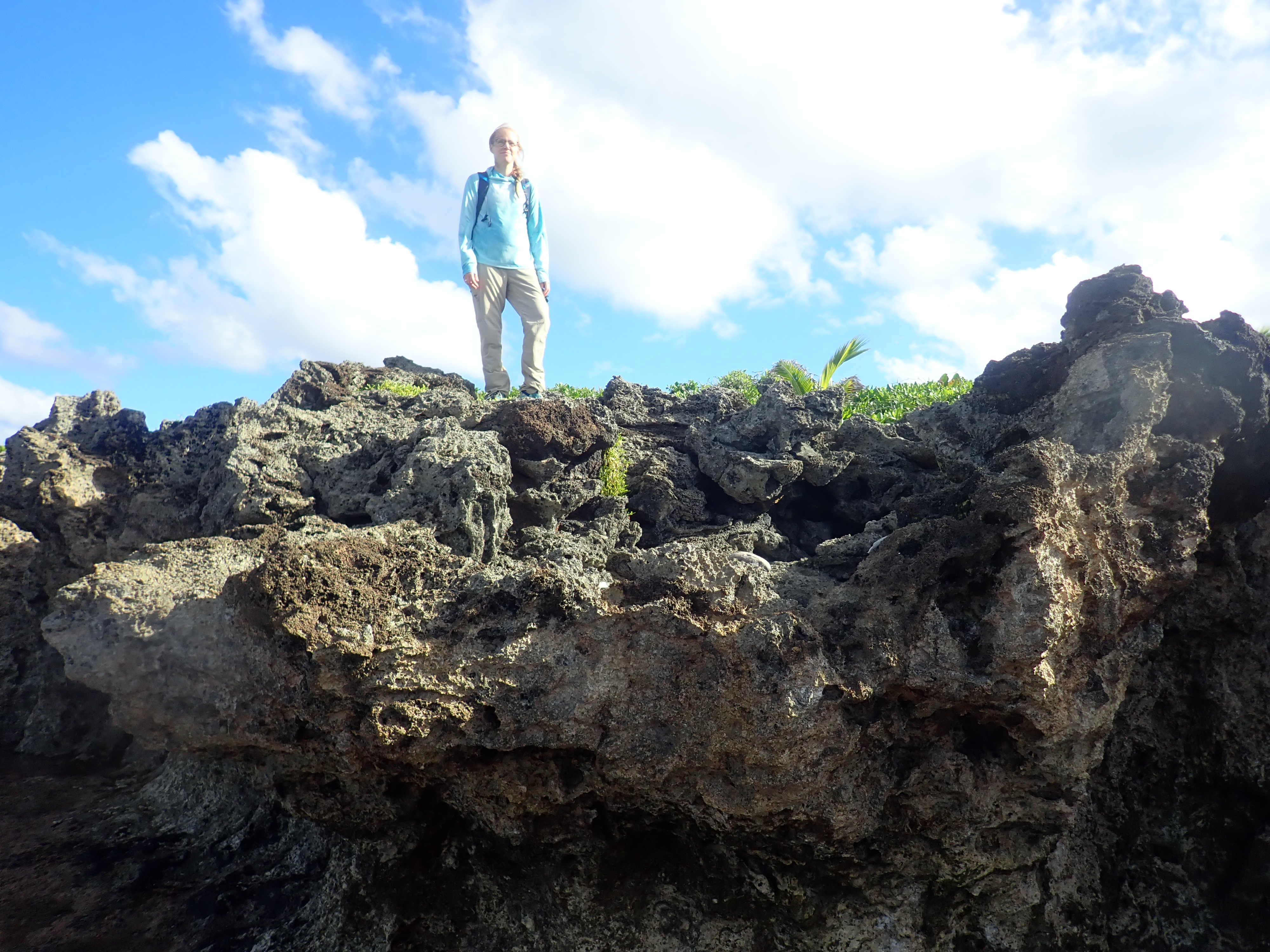
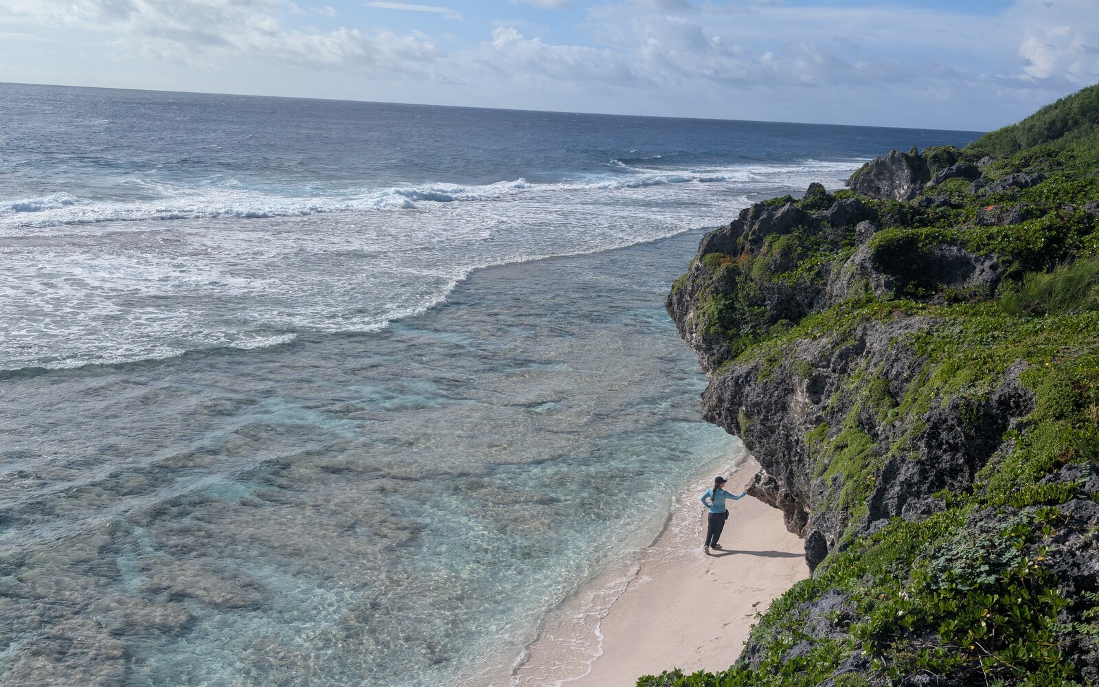
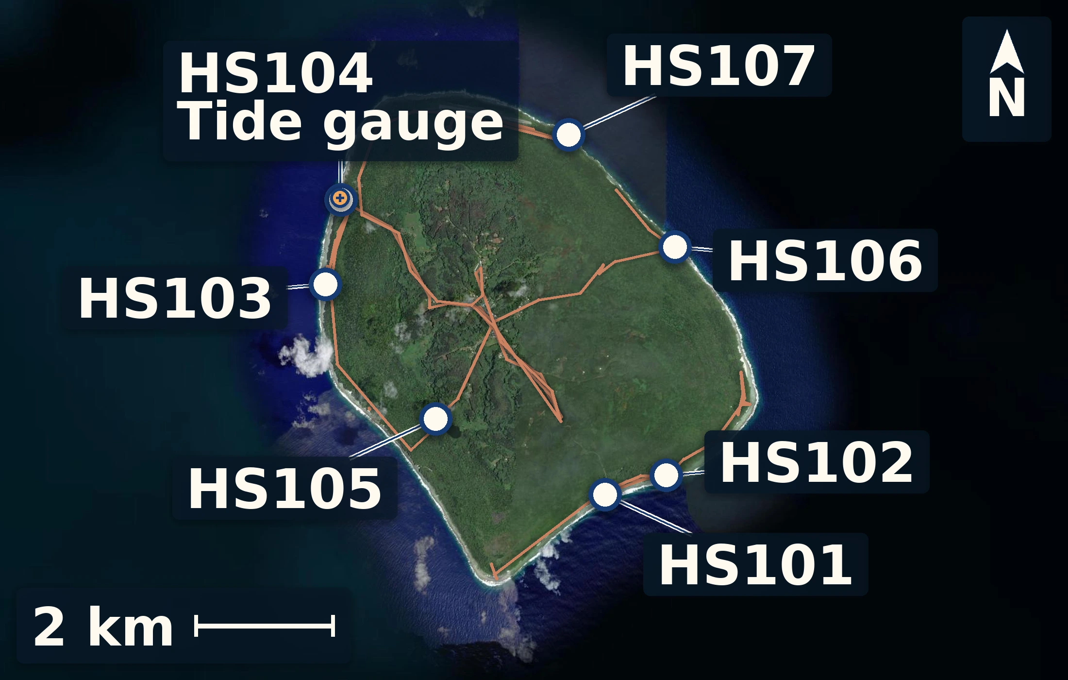
Atiu let us follow exposed reef from the present shoreline into raised jungle-covered limestone. At Matai a lower layer of branching coral framework was distinct from higher coral framework. Rough waves limited work at Takauroa, but the stop documented how exposure controls both access and preservation. Oravaru and Taunganui showed lower reef framework, sand or discontinuous layers, upper rubble or reef units, and fresh harbor-wall textures. Old Canyon and the inland quarry exposed strongly recrystallized limestone, useful for understanding alteration but less useful for dating. At Tarapaku, living Porites-rich reef, microatoll forms, cemented surfaces, and a nearby notch provided a modern guide to possible sea-level indicators. Totiko was the final stop with a higher reef table and clustered coral samples. The temporary tide gauge deployed at Atiu's harbor provides the local height reference needed to test whether these surfaces record one reef-building interval or several different episodes.
7 numbered sites 35 samples 5 surface models
7 numbered sites · 35 samples · 5 surface models
Height reference
Atiu tidal datum
Four days at the harbour
Working field reference
The harbour record establishes local mean sea level—our zero. Measured features are reported relative to this surface so the reef, notch, and shore can be compared on one scale.
working local datum · 14.23 m
- mean water above logger
- 1.85 m
- gauge tie
- 3.32 m
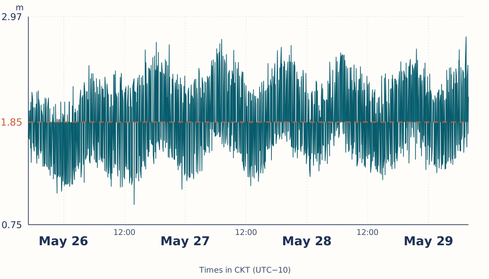
Whiskers show the field screening range, not a formal confidence interval.
The screened logger record preserves the observed tidal variation.
Site records
Brief field views from Atiu
A few maps, photographs, and observations from surveyed sites.
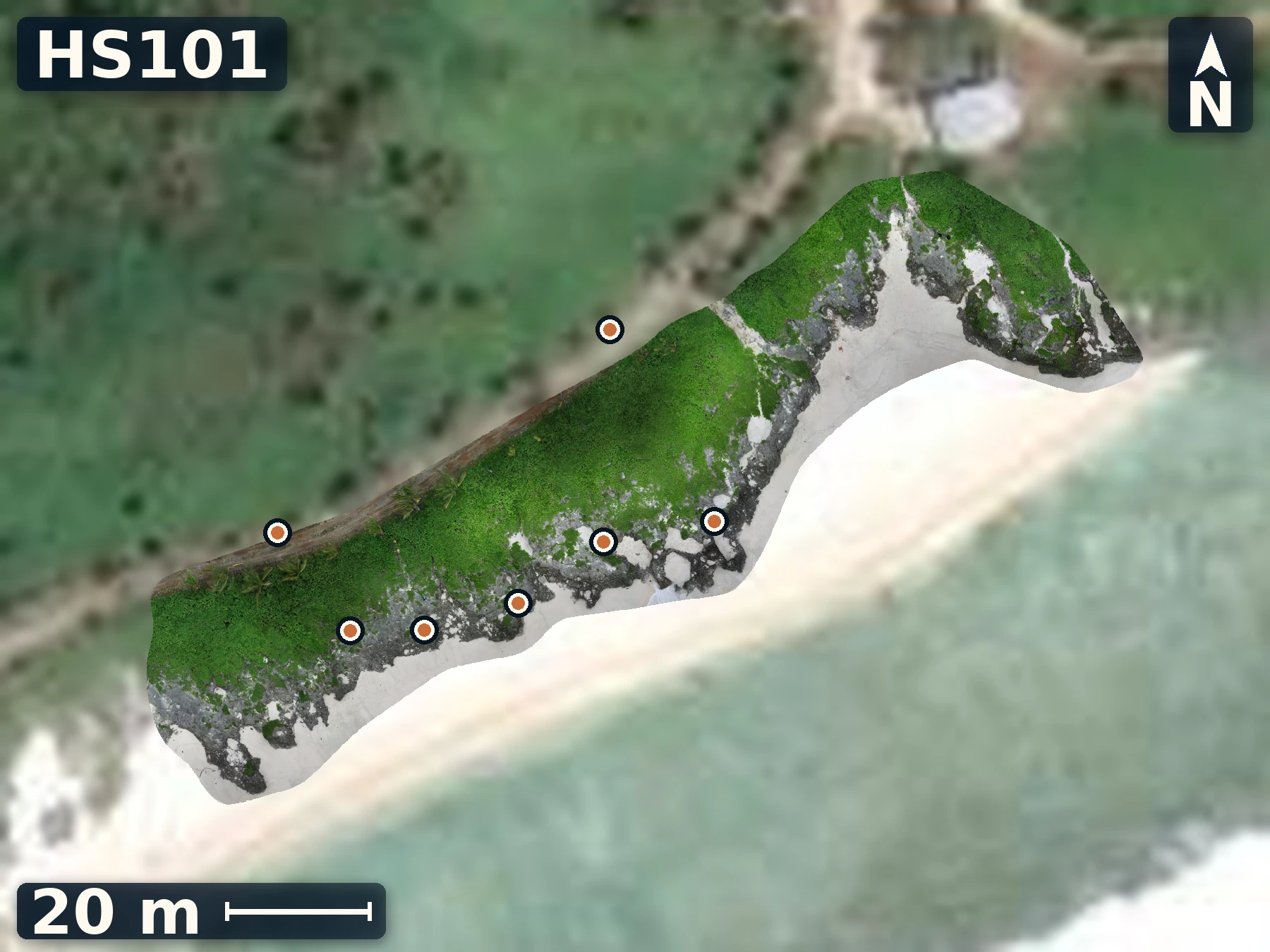
HS101
Matai
May 26, 2026
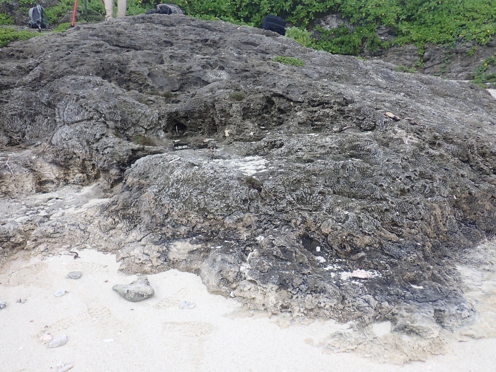
Matai tests whether lower, large branching framework and higher mixed coral forms represent one variable reef body or a meaningful internal boundary.
Open QuestionDoes the framework transition reflect reef position, exposure, preservation, or a true depositional break?
Explore more field evidence
A high-resolution drone orthomosaic and elevation model are available for HS101.
- Lower seaward framework includes in-place upward-branching colonies several metres to tens of metres across.
- Higher landward framework shifts to smaller branchers, brain-like, honeycomb, smooth, and encrusting forms.
- No clear sand layer or hiatus was identified; the transition varies by about one metre in elevation.
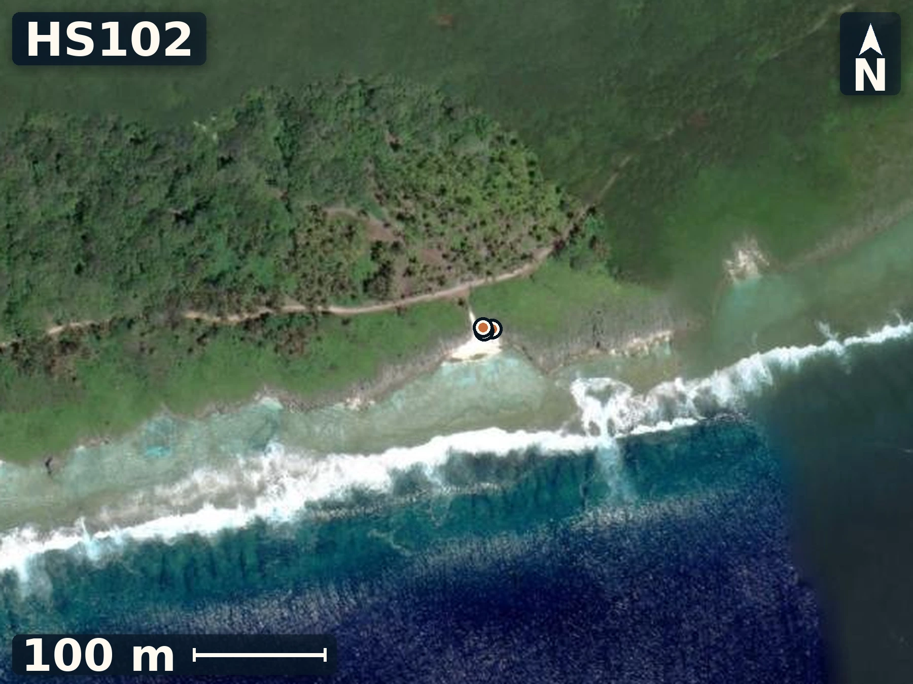
HS102
Takauroa
May 26, 2026
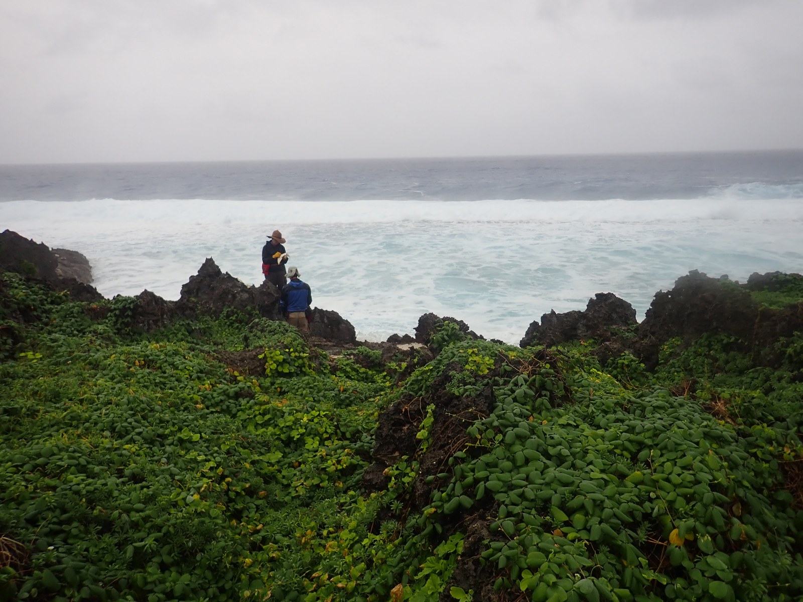
Because rough surf limited imagery, Takauroa’s samples were recorded with only mapped, single photos, and observations as context.
Open QuestionWhich HS102 samples will be the best preserved?
Explore more field evidence
A high-resolution surface model is not currently available for this site; satellite imagery, the mapped sample positions, and field photographs preserve its documented context.
- Tabular or encrusting coral occurs near a possible framework–infill contact.
- Rough waves prevented drone photography, so mapped sample positions carry much of the comparison.
- Samples A–D span several coral colonies that form part of the site's reef framework.
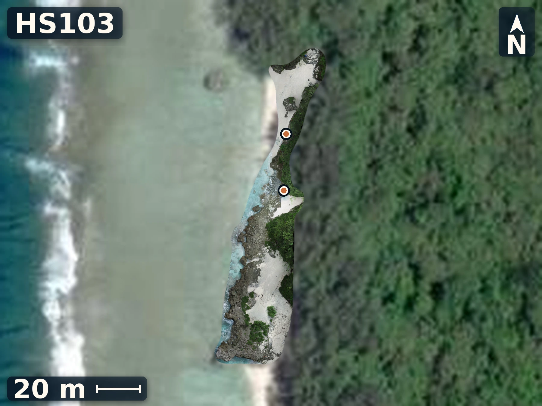
HS103
Oravaru
May 27, 2026
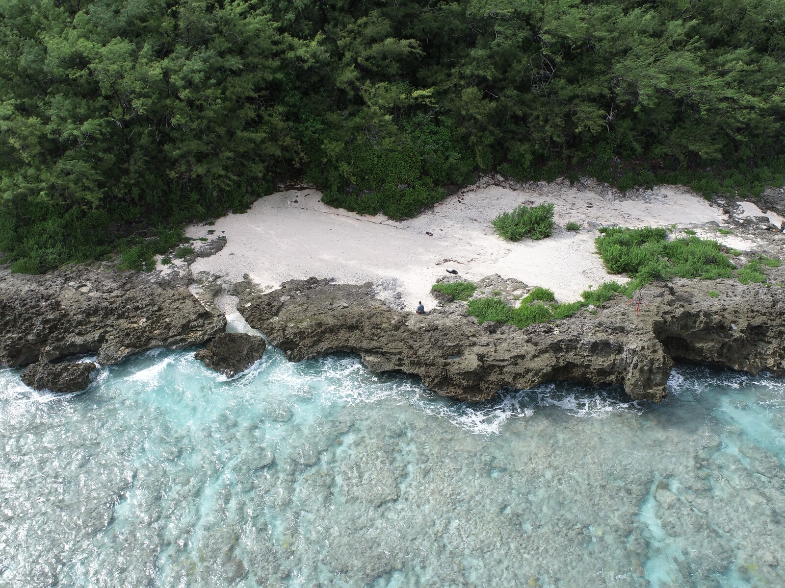
Oravaru preserves reef growth and sedimentation, making it Atiu’s clearest exposure for testing the continuity and meaning of its sand-rich interval.
Open QuestionDo the elevation and ages of measured within-reef contacts align with other Atiu sites?
Explore more field evidence
A high-resolution drone orthomosaic and elevation model are available for HS103.
- Coarse angular sand forms pockets and sheets that drape positive reef relief rather than one continuous bed.
- Localized lenses preserve ripples, 10–15 cm tabular cross-beds, coral clasts, and breccia blocks.
- Later corals appear to recolonize the sand surface, possibly after encrusters or cement stabilized it.
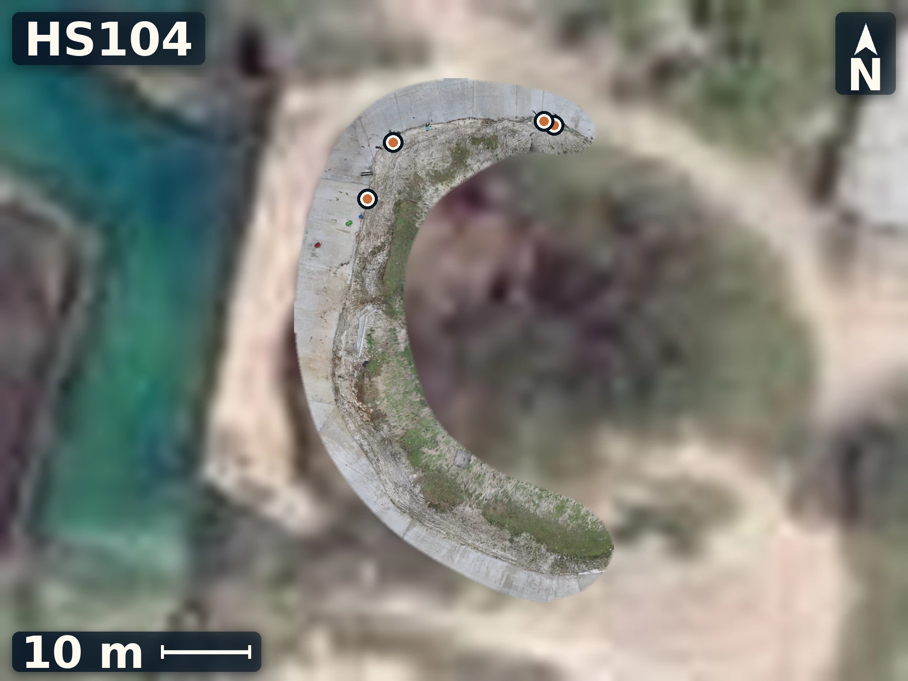
HS104
Taunganui
May 27, 2026
Taunganui tests whether the lower-coral and upper-rubble pattern seen at Oravaru persists where sand is less obvious.
Open QuestionDo contacts align in elevation? The contacts are not flat, so must be traced across each outcrop.
Explore more field evidence
A high-resolution drone orthomosaic and elevation model are available for HS104.
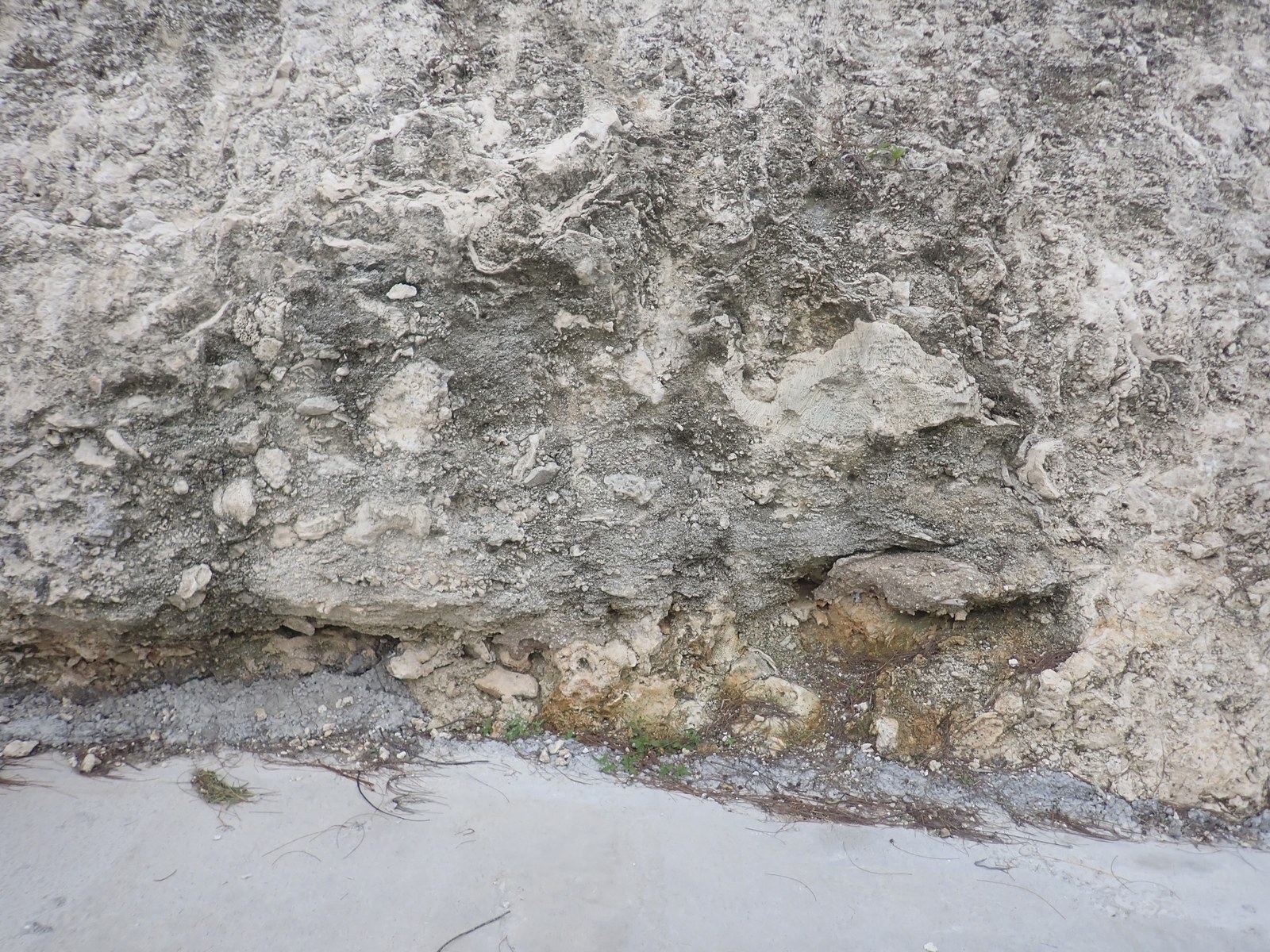
- Large colonies dominate the lower exposure; cemented rubble, delicate algae, and small corals characterize the upper jumble.
- Several encruster horizons cross the wall rather than forming one simple horizontal layer.
- The fresh cut makes fabrics visible that are harder to distinguish on weathered surfaces.
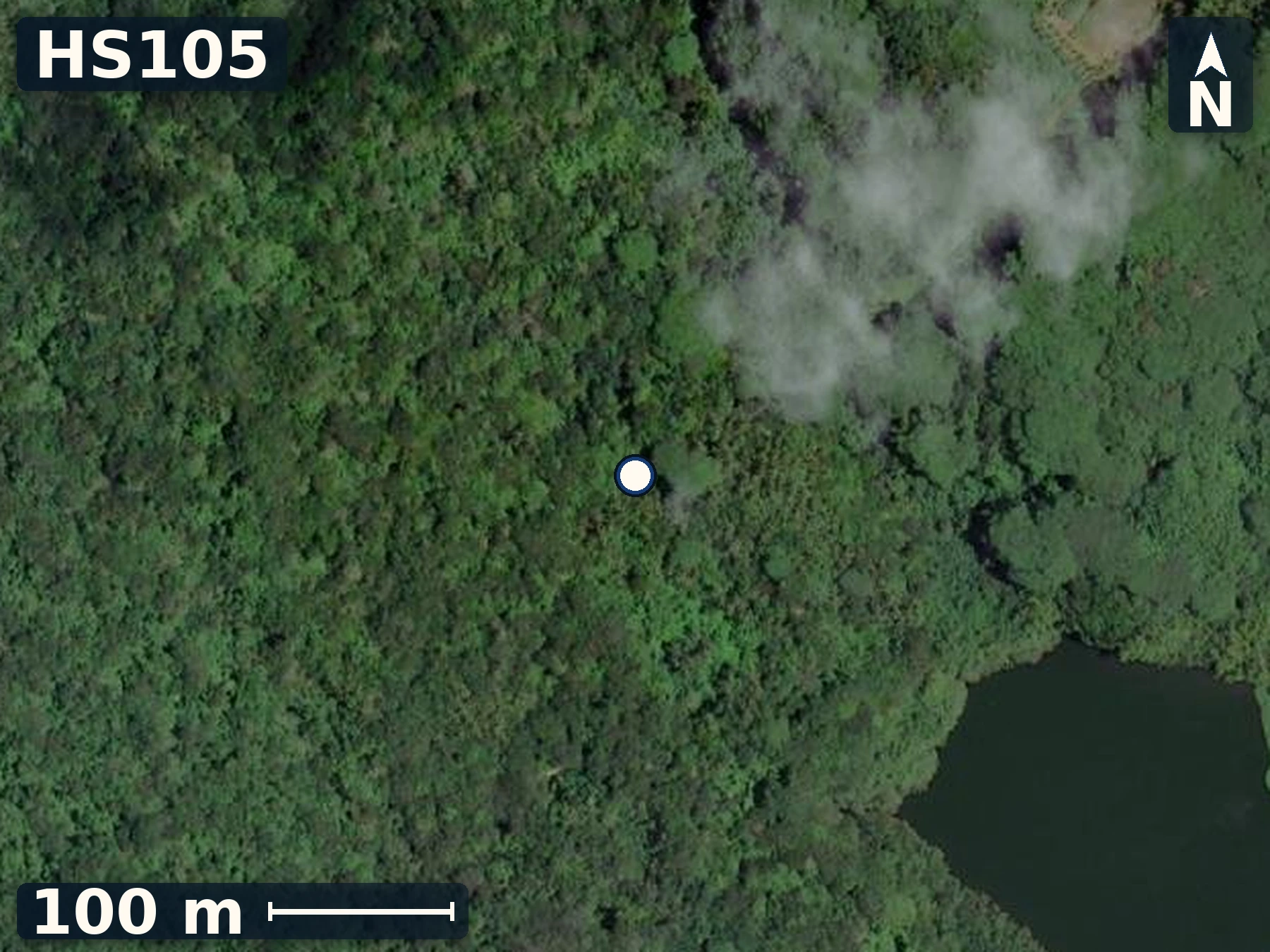
HS105
Old Canyon
May 27, 2026
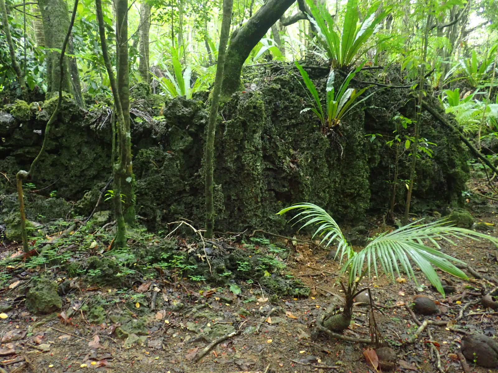
This Old Canyon road offers views into inland makatea where strong recrystallization currently makes it contextual rather than secure dating material.
Open QuestionDoes the elevation of this exposure require an earlier interglacial period than the coastal sites?
Explore more field evidence
A high-resolution surface model is not currently available for this site; satellite imagery, the mapped site position, and field photographs preserve its documented context.
- The inland limestone remains recognizably marine, with coral and shell fragments and visible corallites.
- No obvious notch or front-edge feature links this exposure directly to the lower elevation coastal sites.
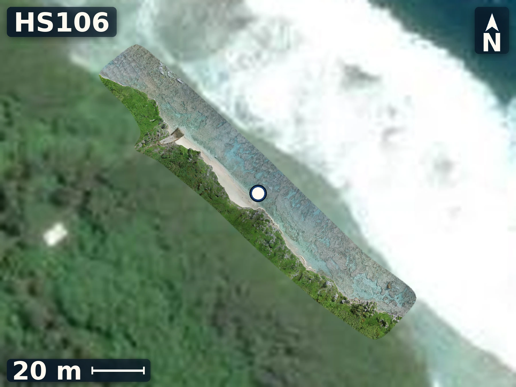
HS106
Tarapaku
May 28, 2026
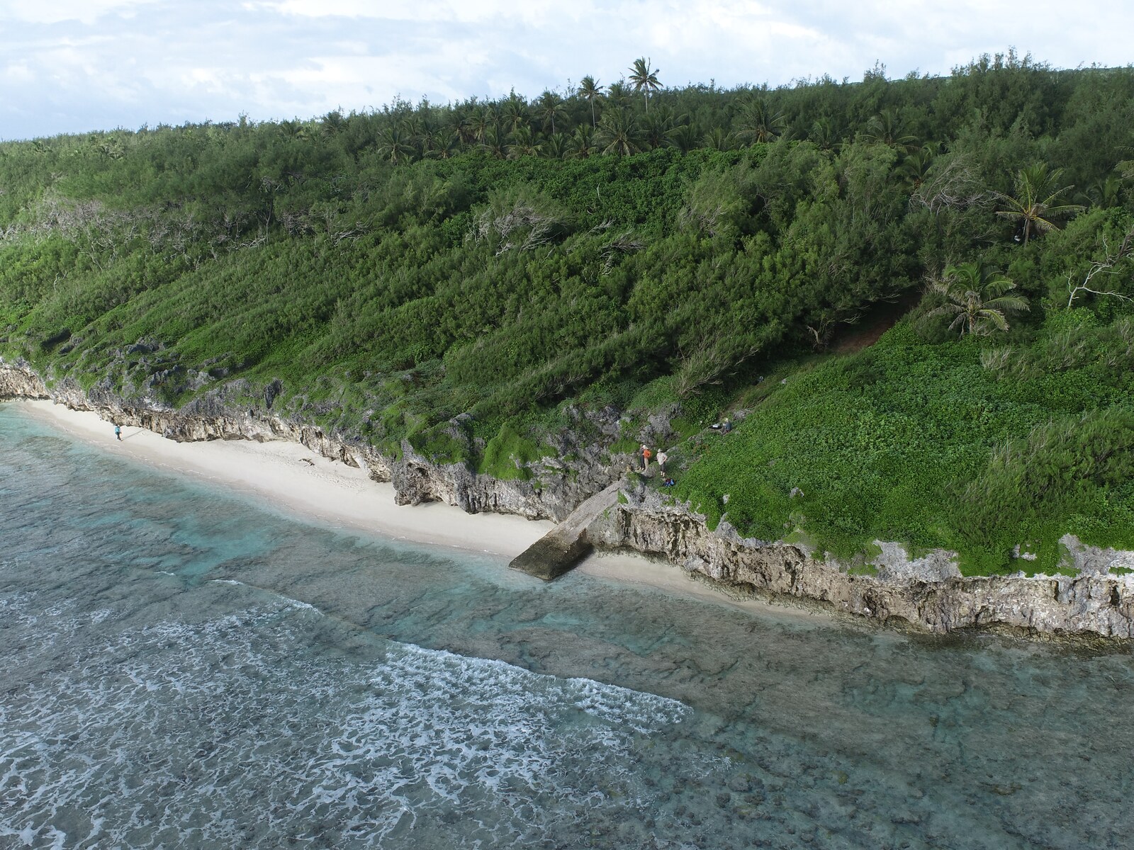
Tarapaku pairs a raised-framework section with nearby living reef and notch observations, providing a cautious modern comparison for possible sea-level indicators.
Open QuestionDoes the raised section contain short, horizontal coral forms comparable to modern Tarapaku microatolls?
Explore more field evidence
A high-resolution drone orthomosaic and elevation model are available for HS106.
- Large intact metre-scale corals occur low in the exposure; smaller corals, encrusters, and framework dominate higher levels.
- No clear microatoll-style flat was identified within the examined upper jumble.
- The nearby modern notch and coral rich reef flat provide height and morphology checks for reef flat environments.
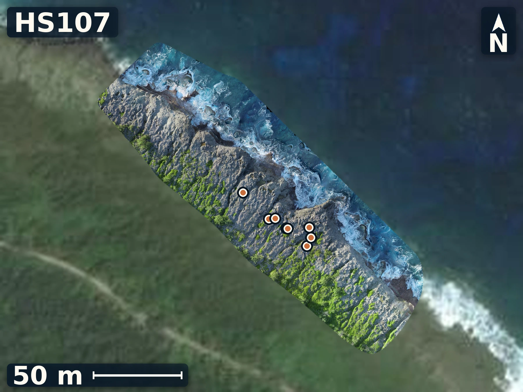
HS107
Totiko
May 28, 2026
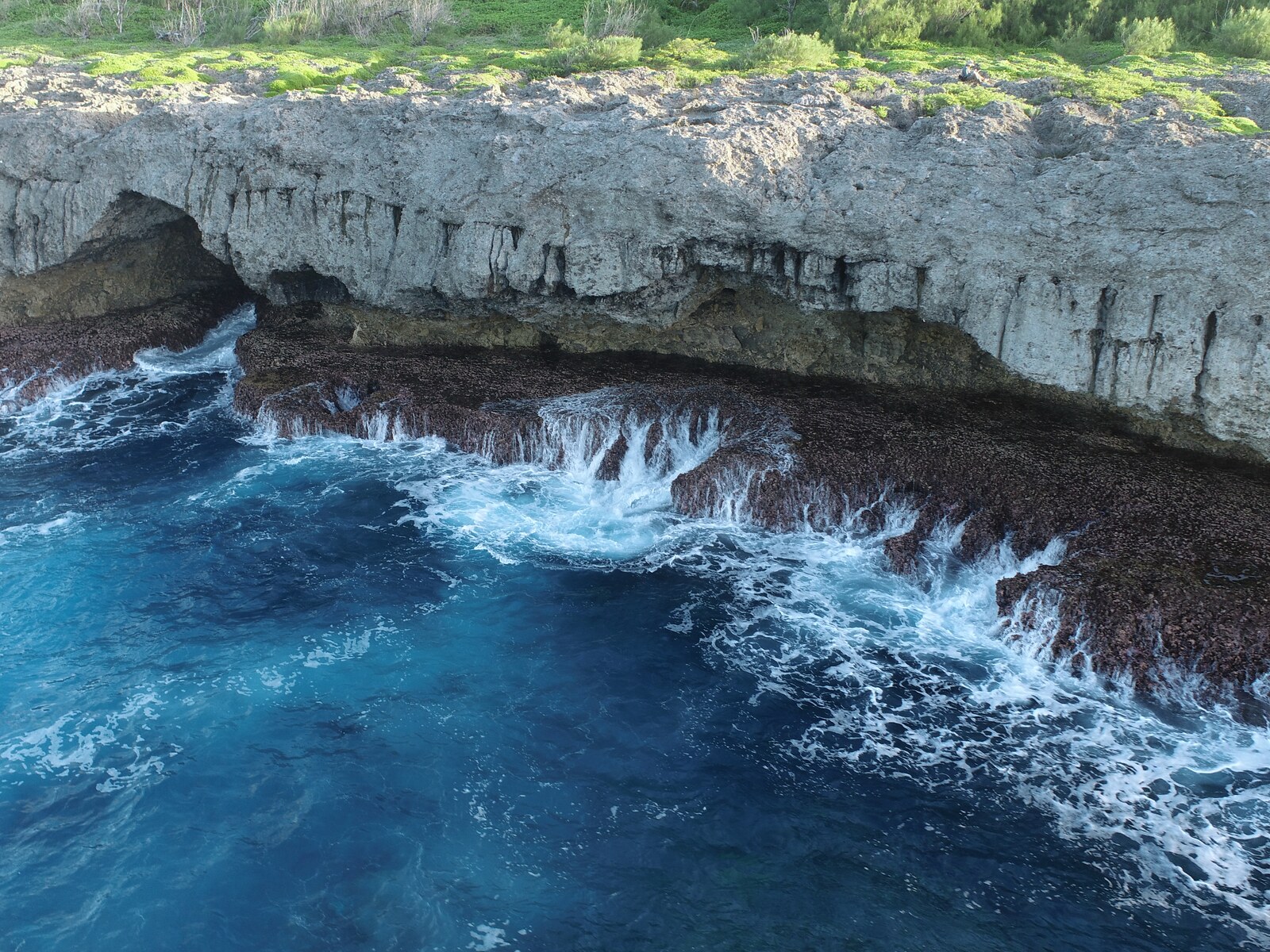
Totiko provides a weathered reef table whose exposed fabrics, sample positions, and surface geometry can be compared with Atiu’s published reef-unit framework.
Open QuestionAre Totiko’s gullies and ridges primary constructional and wave generated relief, or products of rockfall and later weathering?
Explore more field evidence
A high-resolution drone orthomosaic and elevation model are available for HS107.
- The rough table contains abundant in-place corals, articulated tridacnid clams, other bivalves, and gastropods.
- Meter-scale coral clumps and ocean-oriented gullies form substantial local relief despite the table’s broad flat appearance.
- Multiple coral samples were tied to mapped positions across the reef table.
Island 3 of 5
Mangaia
Field records · June 1-4, 2026
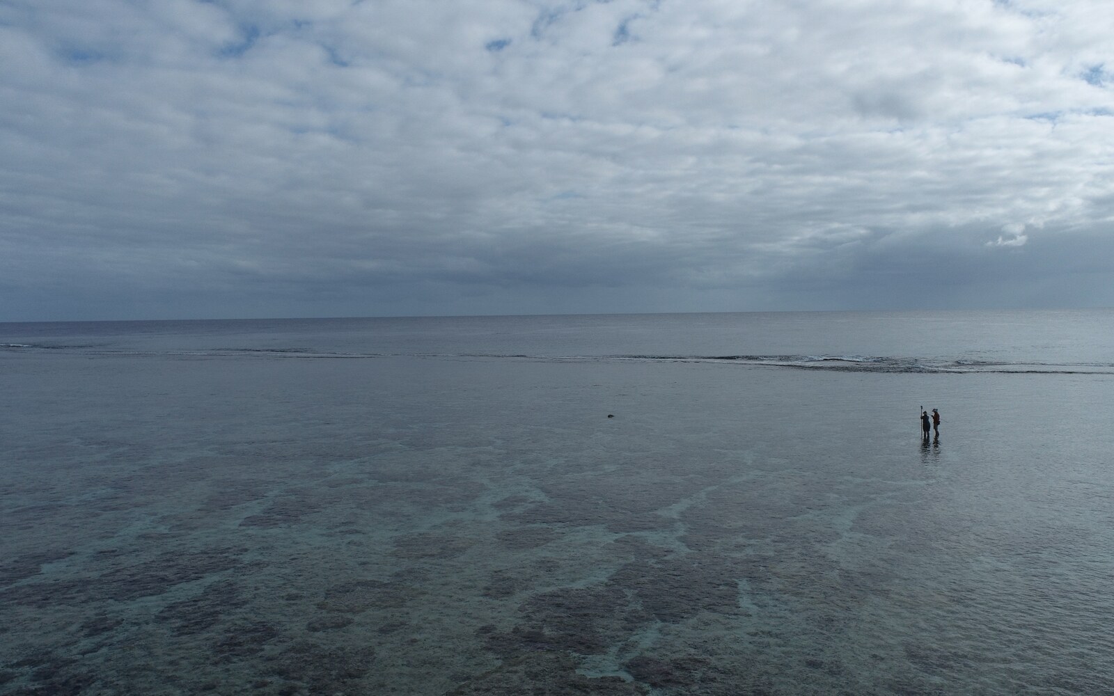
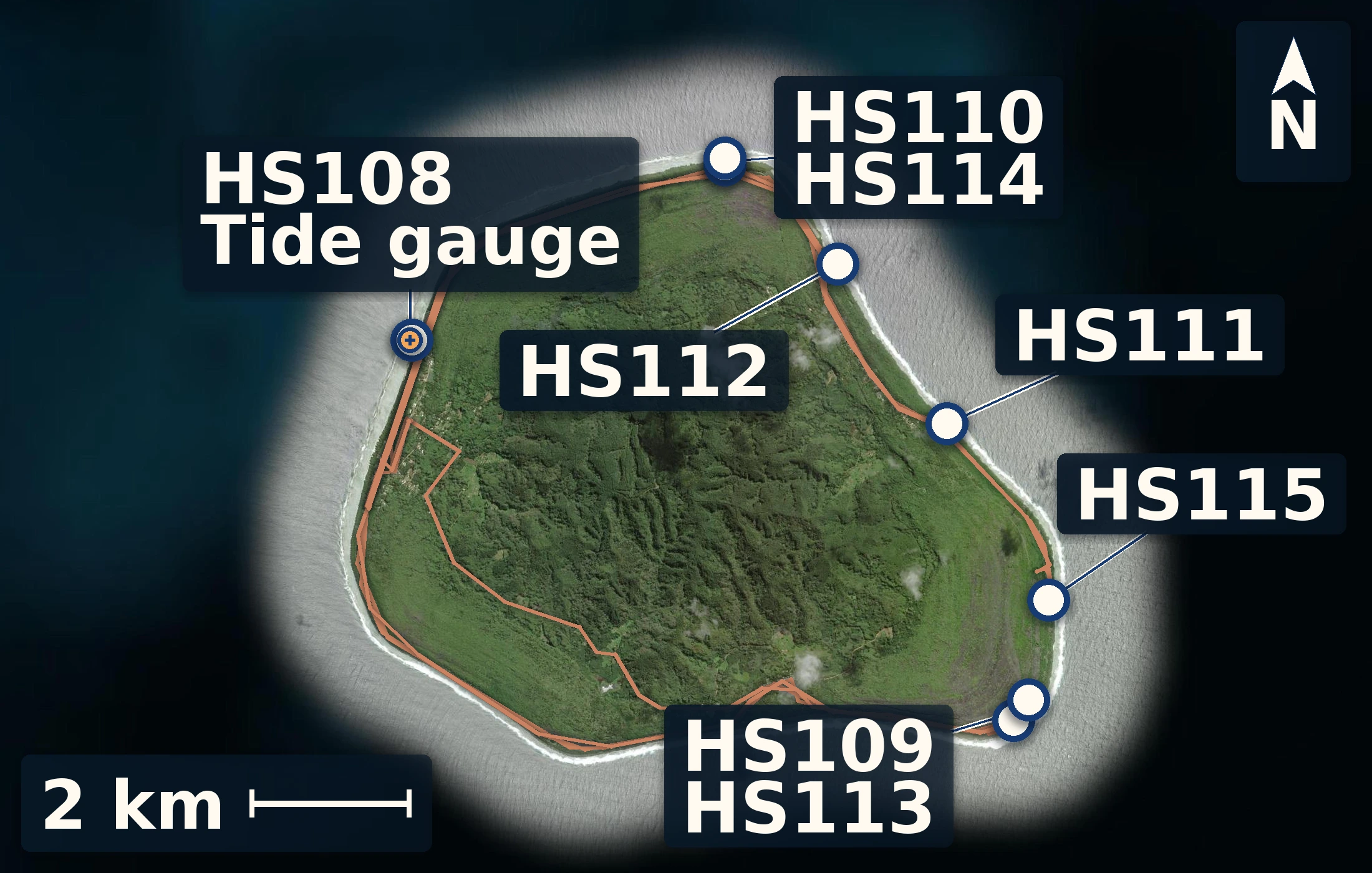
Mangaia presented the clearest multi-level reef problem of the trip. The Avarua harbor reef flat and tide gauge established the modern starting point. Saragossa I exposed dense fossil coral framework, channelized textures, recrystallized grainstone, and coral-bearing rock near the next inland cliff. At Araoa, notch-like forms, infill, and adjacent reef framework offered several competing histories. Ivirua and Karanganui provided strong growth-position framework comparisons beside modern low-tide surfaces. Higher on the island, Saragossa II contained intermediate coral-rich highs that may be patch reefs rather than a single continuous terrace. The modern Araoa survey measured water depth across a living reef flat, while Saragossa III extended the work toward higher mounds, cliff-attached reef, and possible fallen or collapsed blocks. Together these sites show that Mangaia cannot be explained as one simple sea level highstand. Dating, high-resolution surface models, and the working local tidal datum will be used to learn which features formed together and which record local relief, channels, erosion, or collapse.
8 numbered sites 41 samples 7 surface models
8 numbered sites · 41 samples · 7 surface models
Height reference
Mangaia tidal datum
Four days at the harbour
Working field reference
The harbour record establishes local mean sea level—our zero. Measured features are reported relative to this surface so the reef and shore can be compared on one scale.
working local datum · 12.47 m
- mean water above logger
- 0.70 m
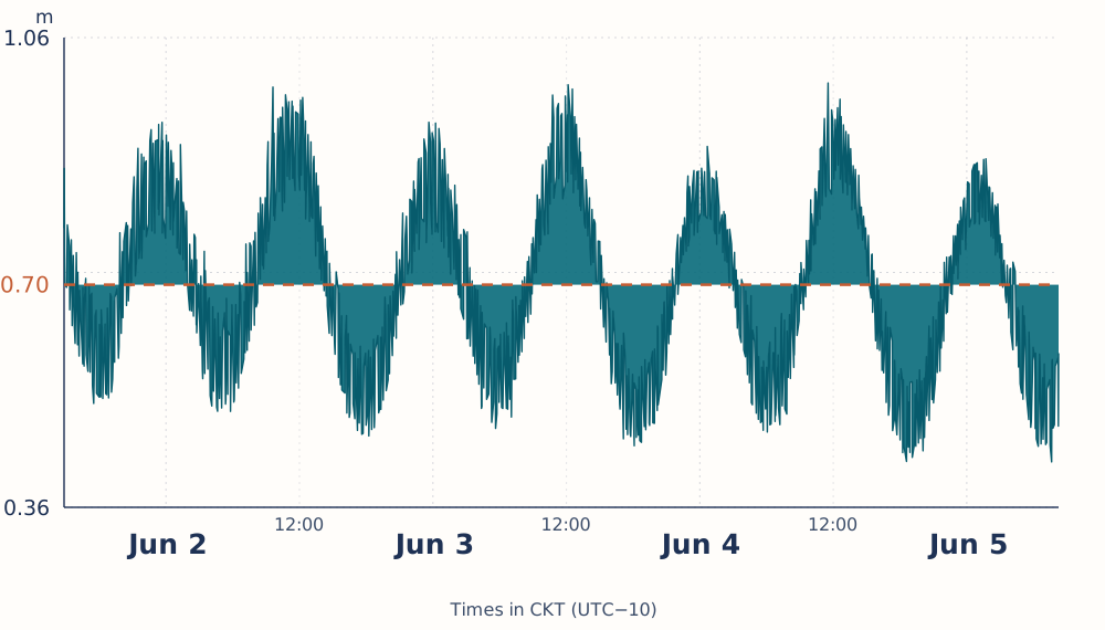
Whiskers show the field screening range, not a formal confidence interval.
A pressure offset was corrected using the stable post-retrieval record; tidal variation is preserved.
Site records
Brief field views from Mangaia
A few maps, photographs, and observations from surveyed sites.
HS108
Avarua
June 1, 2026
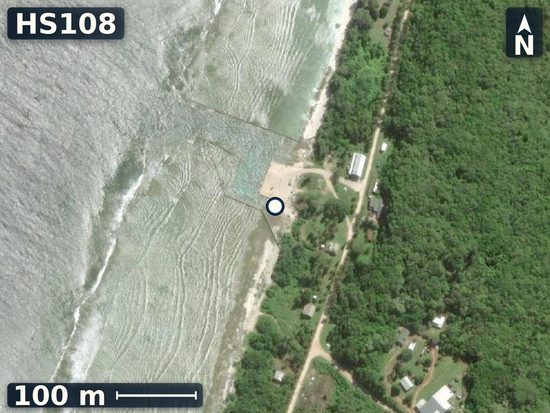
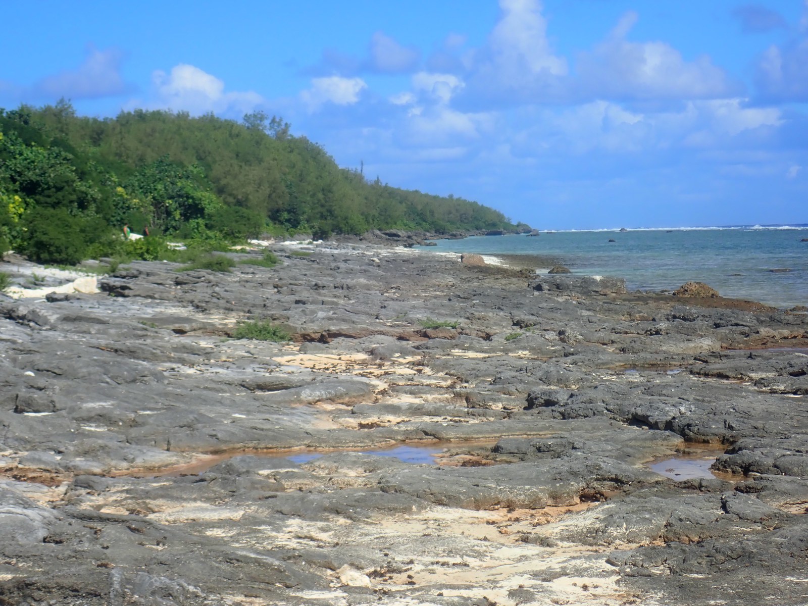
Avarua provides Mangaia’s local height anchor, linking the temporary tide gauge and repeated ties to the low coastal surfaces compared across the island.
Open QuestionAre harbor adjacent units from the last interglacial period or the early holocene?
Explore more field evidence
A high-resolution surface model is not currently available for this site; satellite imagery, the mapped site position, and field photographs preserve its documented context.
- A lower intertidal branching coral colony was recorded on the harbor reef flat.
- Repeat tide-gauge points provide the principal local control for later height corrections.
HS109
Saragossa I
June 1, 2026
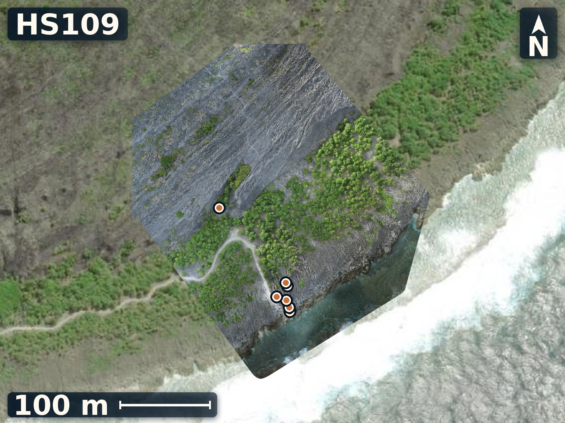
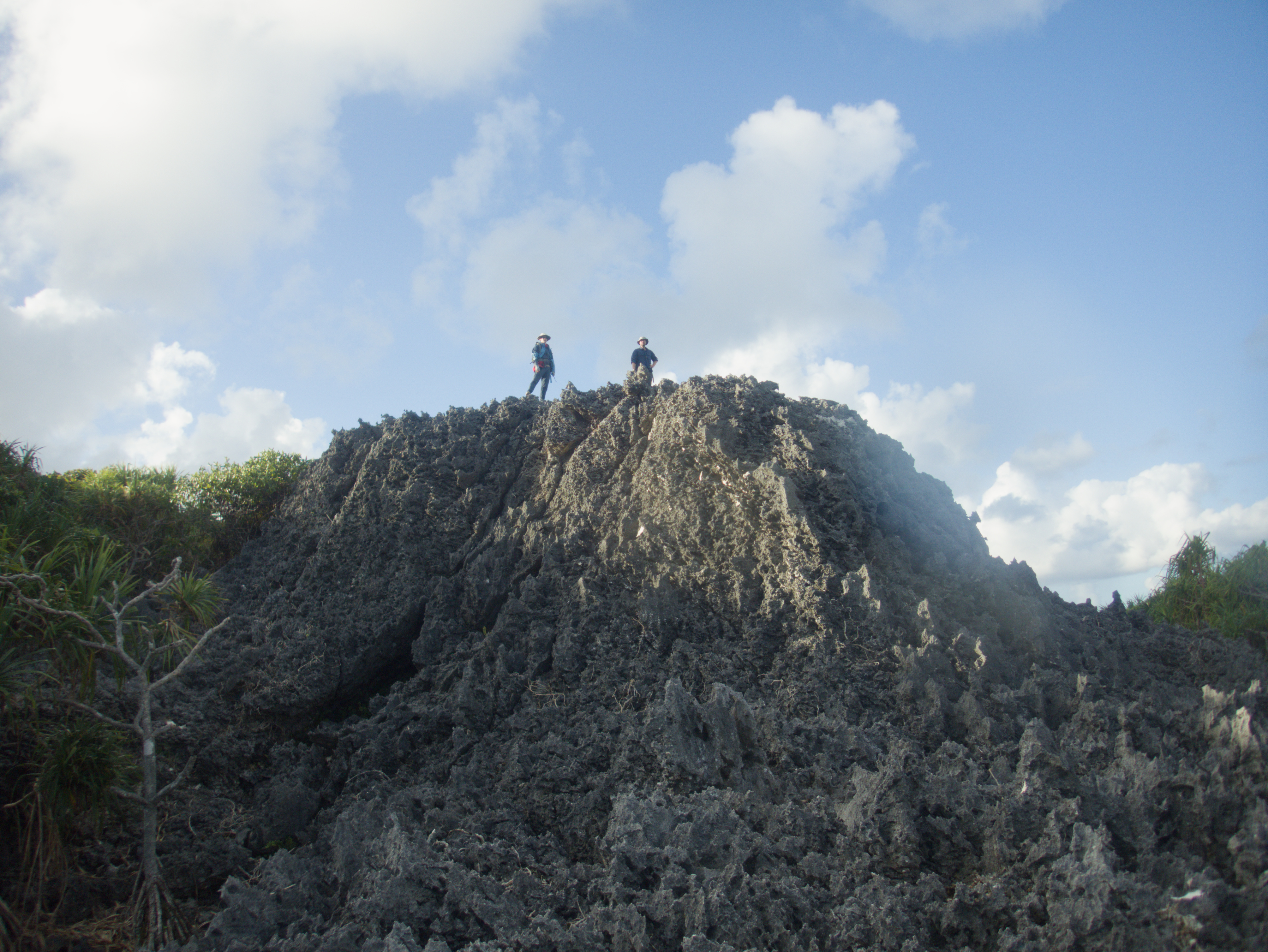
Saragossa I connects a fossil-reef sampling transect from coastline all the way to a second inland cliff within one mapped section.
Open QuestionDo fractures and cracks align with broader patterns seen from above?
Explore more field evidence
A high-resolution drone orthomosaic and elevation model are available for HS109.
- The road-adjacent upper unit is heavily recrystallized grainstone, unlike the fresher coral framework.
- Coral samples A–G and a Tridacna were documented across the main exposure.
- The inland cliff base exposes sharp makatea and a coral head beyond the road-adjacent unit.
HS110
Araoa
June 2, 2026
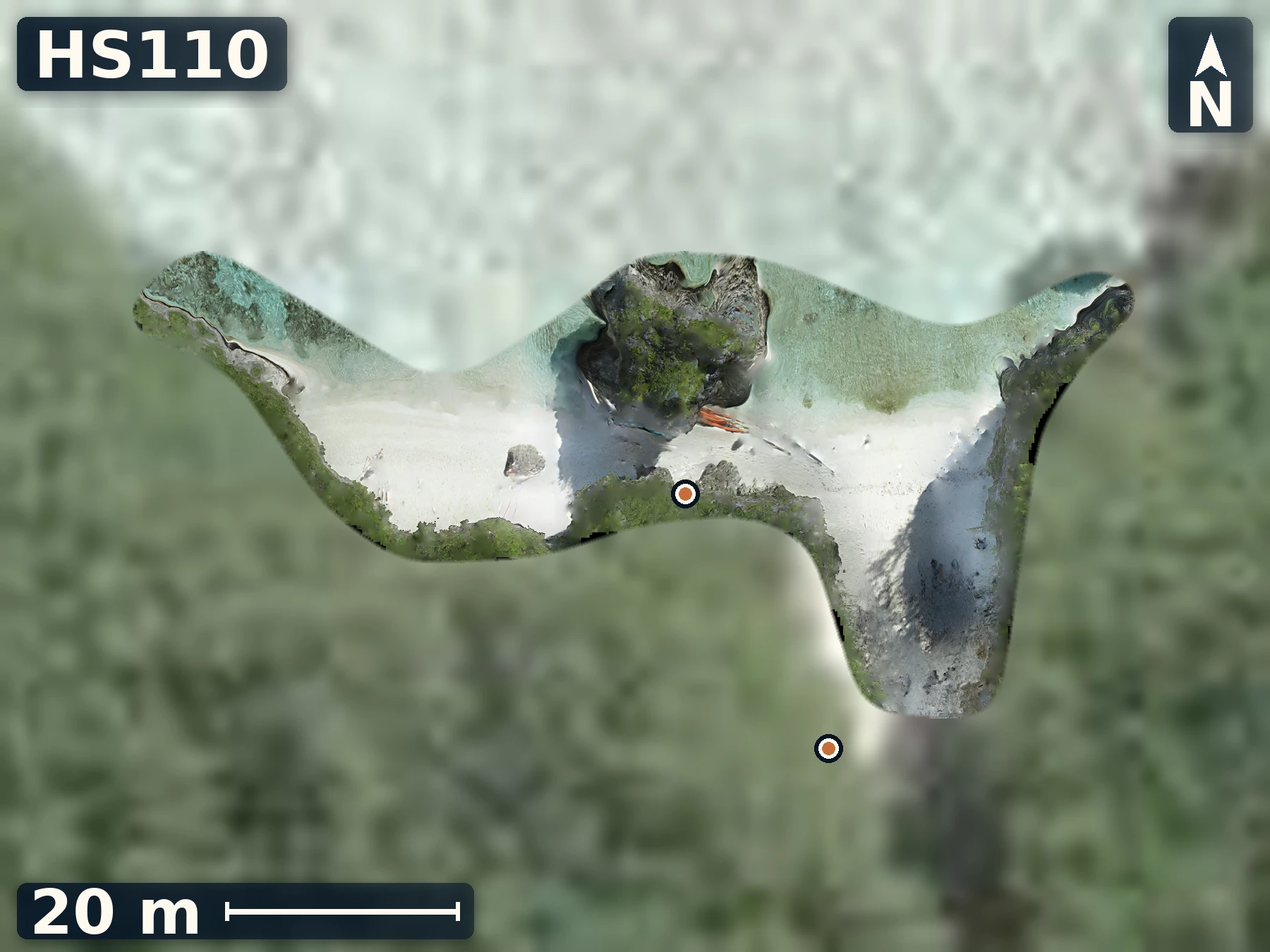
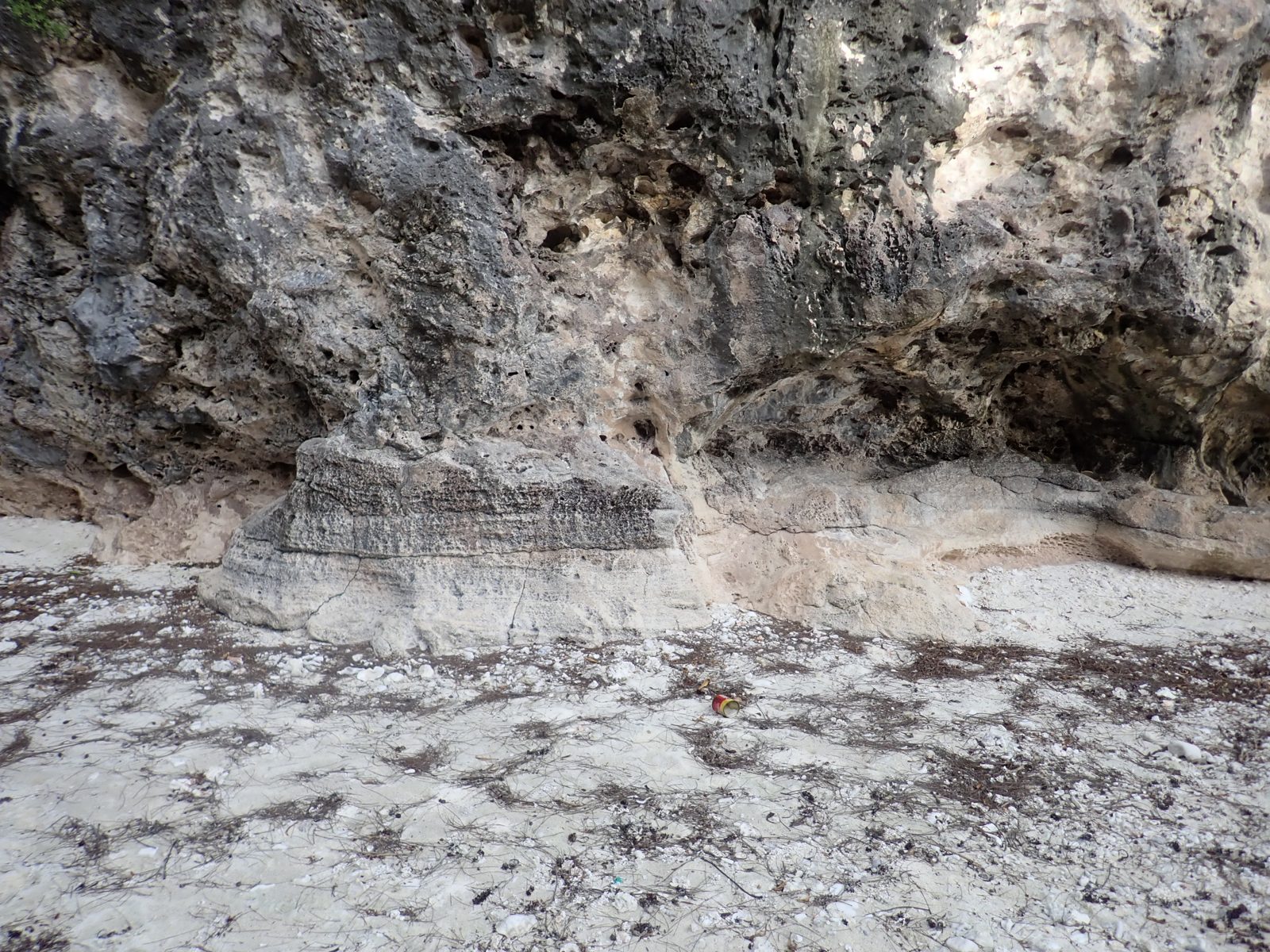
Araoa poses a difficult puzzle on how reef construction, erosion, and later filling or recolonization. Without geochonology, several emplacement histories remain plausible.
Open QuestionWas the drilled Porites growing in place, or reworked into younger cemented fill?
Explore more field evidence
A high-resolution drone orthomosaic and elevation model are available for HS110.
- The drilled Porites may be in place, fallen from the cave wall, or incorporated into cemented infill.
- Samples were collected from the front face, a possible younger patch, higher cave material, and the previously drilled Porites.
- The upper sample area remains less well constrained by mapped than the outer wall and lower cave.
HS111
Ivirua
June 2, 2026
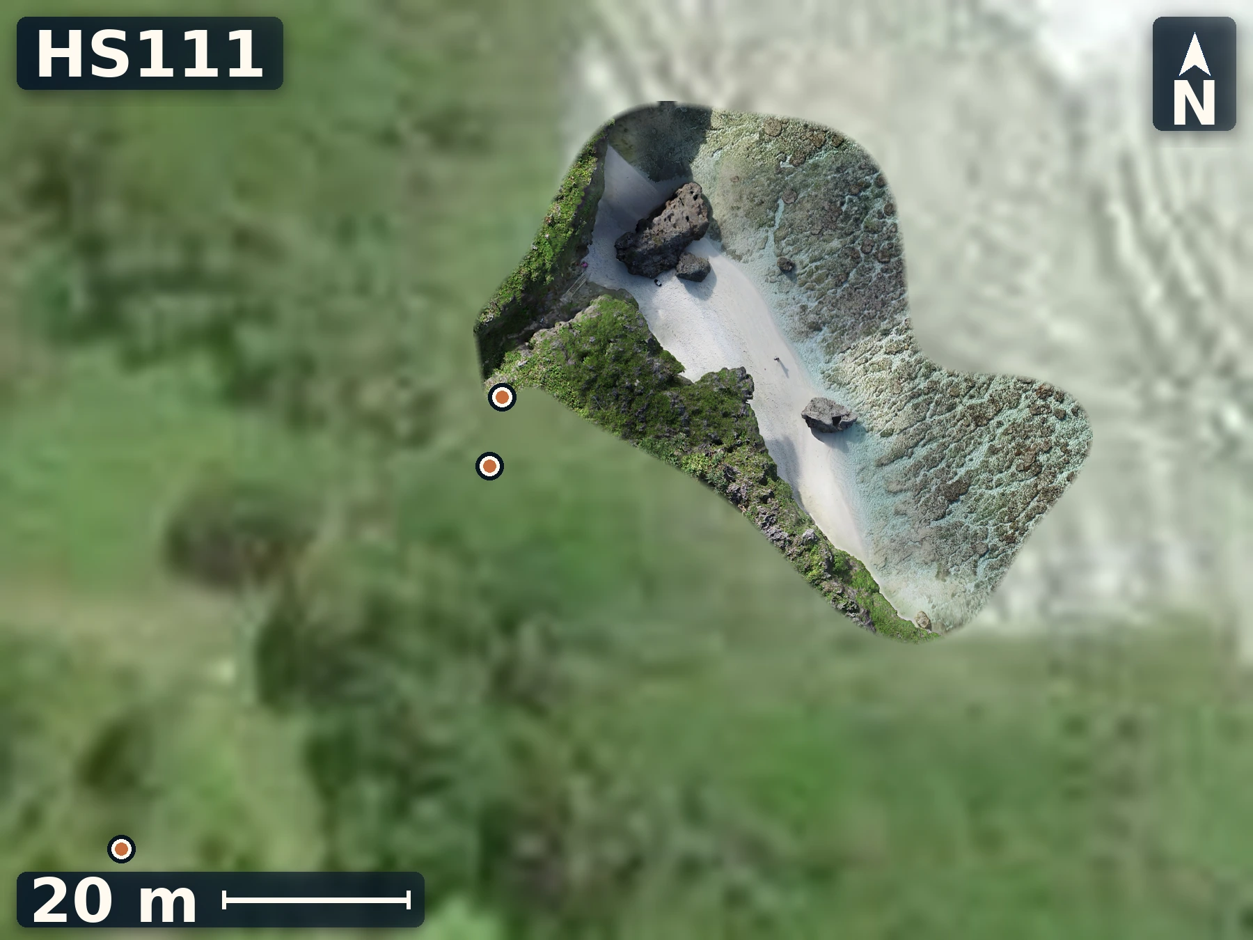
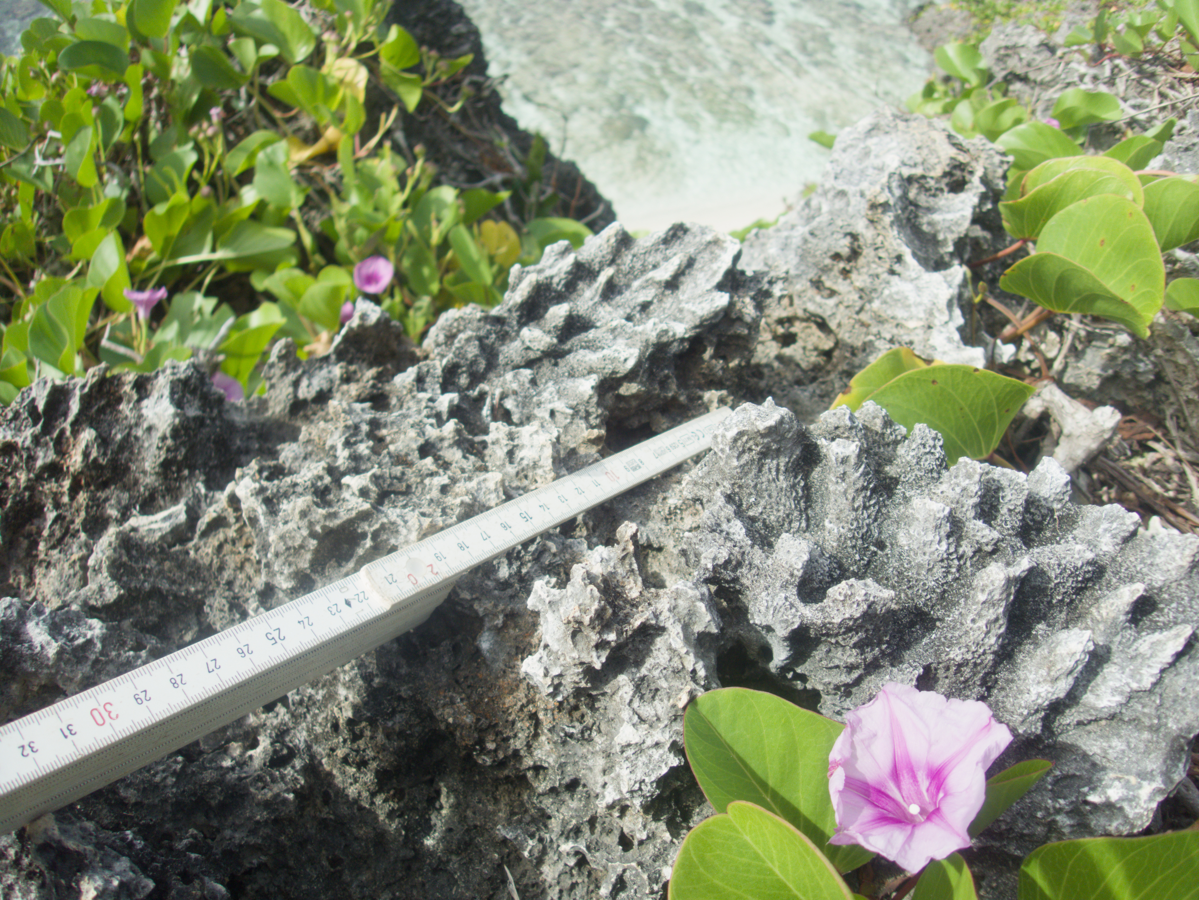
Ivirua offers tests of whether Mangaia’s outer makatea has paleo-surfaces that preserve constructional reef fabric rather than erosion.
Open QuestionDoes Ivirua’s second notch-like horizon reflect a former sea level or another process?
Explore more field evidence
A high-resolution drone orthomosaic and elevation model are available for HS111.
- Large corals were recorded in growth position within the framework.
- Platy or crusting coral forms appear oriented seaward.
- Sample C may be rubble rather than secure bedrock.
HS112
Karanganui
June 2, 2026
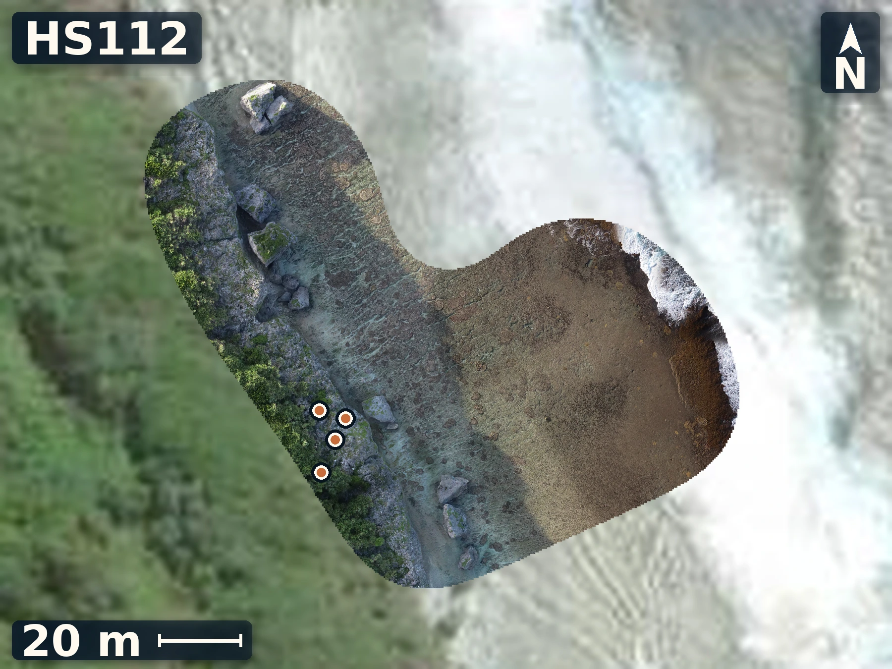
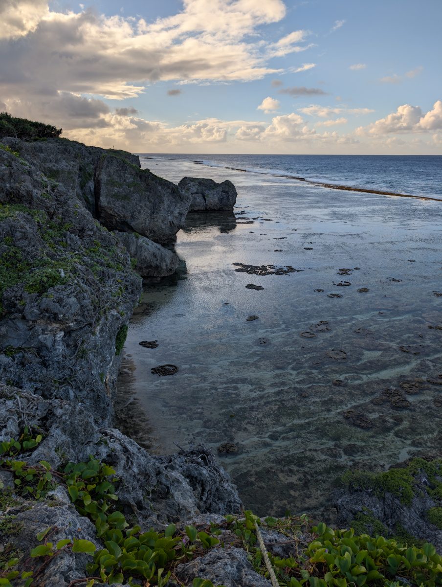
Karanganui extends the Mangaia work with a fossil-framework reef locality with its own sample set, extending preservation and age tests.
Open QuestionDo Karanganui’s dated corals match Ivirua’s reef-building interval despite being a separate exposure?
Explore more field evidence
A high-resolution drone orthomosaic and elevation model are available for HS112.
- Samples A–D and Z were recorded across the framework exposure.
HS113
Saragossa II
June 3, 2026
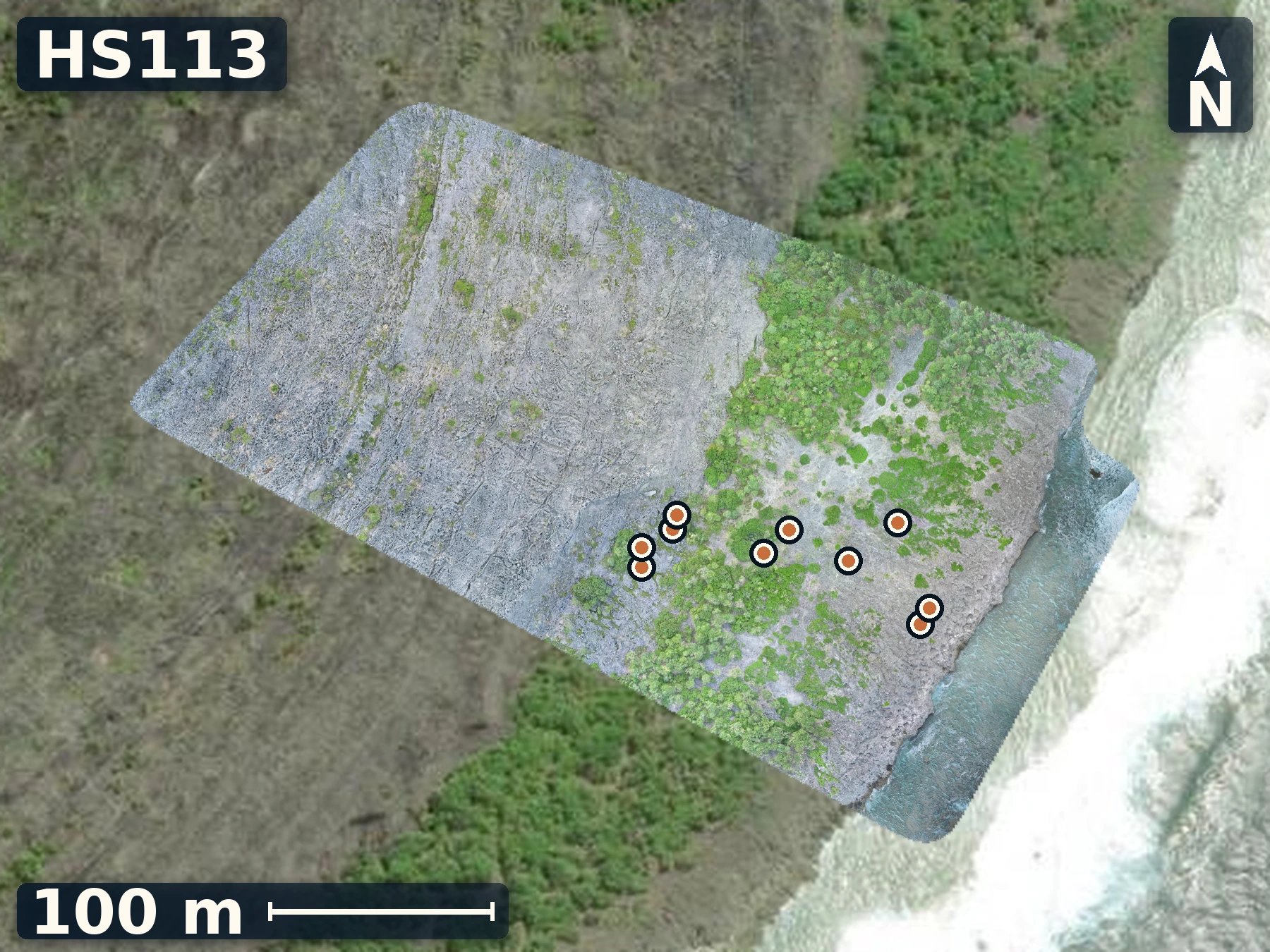
Saragossa II shows how local constructional relief can complicate Mangaia’s stepped-terrace geometry.
Open QuestionAre the intermediate highs separate patch reefs, or remnants of one surface later cut by channels?
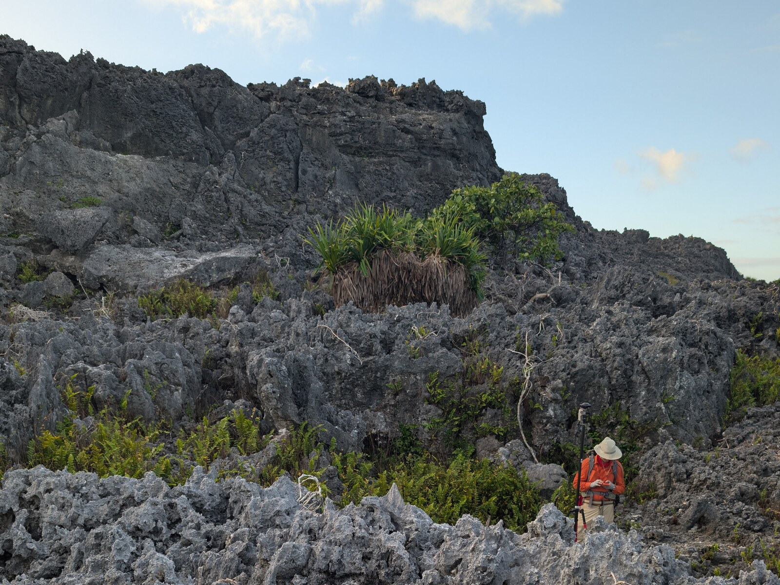
Explore more field evidence
A high-resolution drone orthomosaic and elevation model are available for HS113.
- Diamond-shaped intermediate highs are separated by lower corridors.
- Delicate upward-branching Acropora-like coral dominates the high patches until the traverse enters lower channels.
- Sample I was recorded in growth position and appears better preserved internally than at its exterior.
HS114
Araoa (modern reef)
June 4, 2026
Araoa’s modern reef flat survey supplies a living height-and-water-depth reference needed to interpret fossil reef-flat candidates elsewhere on Mangaia.
Open QuestionHow do tide-corrected HS114 depths and elevations compare with Mangaia’s candidate fossil reef-flat surfaces?
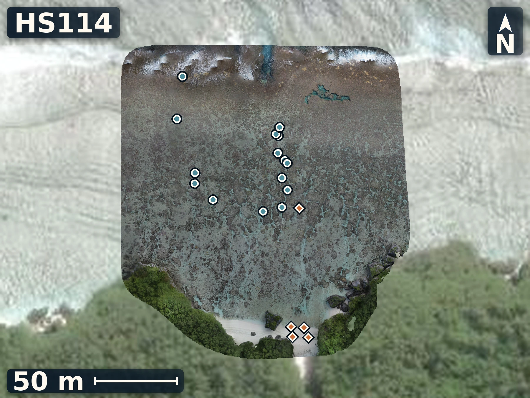
Explore more field evidence
A high-resolution drone orthomosaic and elevation model are available for HS114.
- Water depth and reef-flat elevation were recorded along a dense transect.
- Mapped reference points span the modern reef flat alongside the drone survey.
HS115
Saragossa III
June 4, 2026
Saragossa III extends the Mangaia transect north eastward, testing whether intermediate mounds sitting on the first major flat record primary reef growth or later collapse.
Open QuestionDo HS115’s landward mounds record attached reef growth? If so, from when?
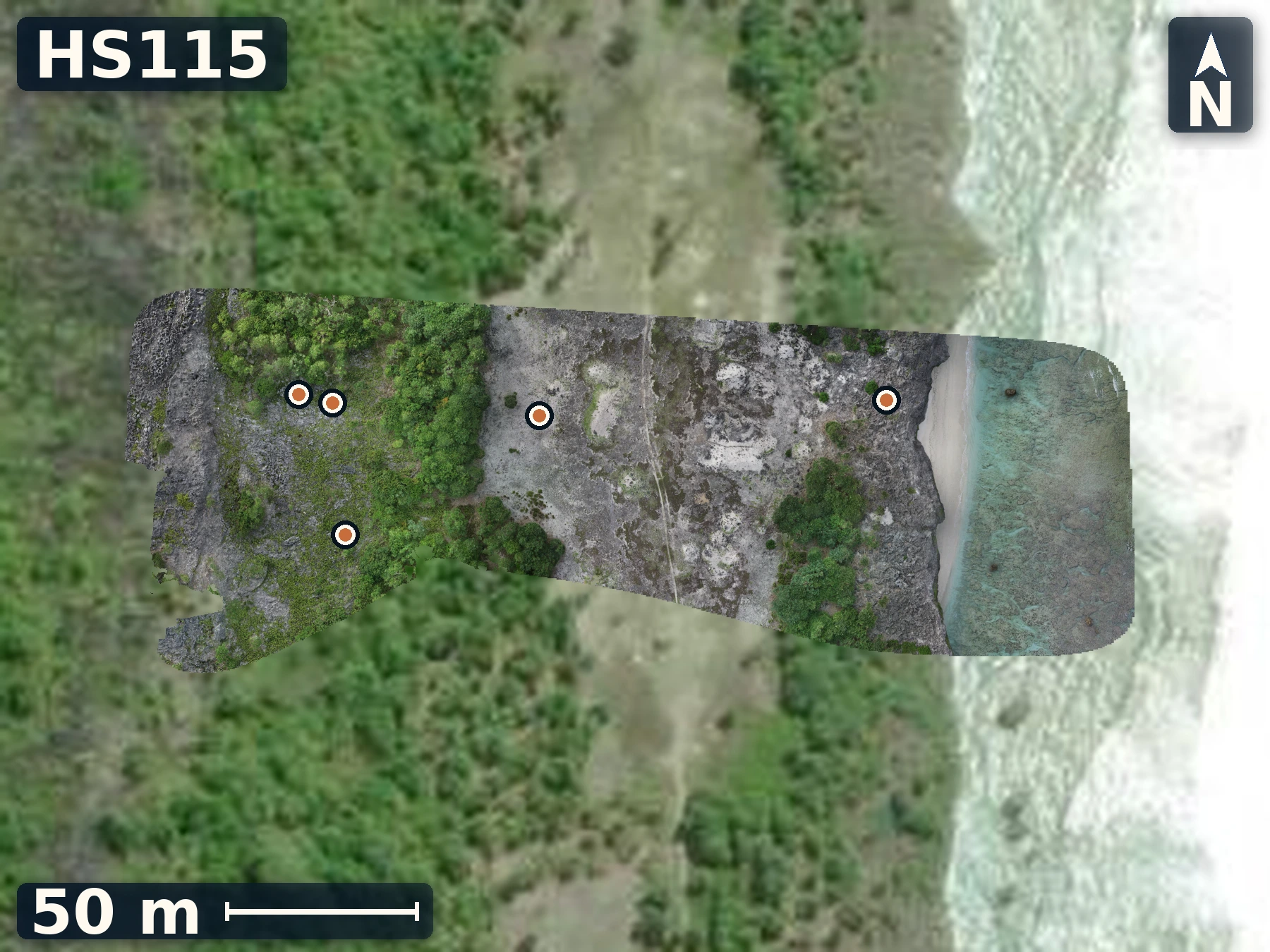
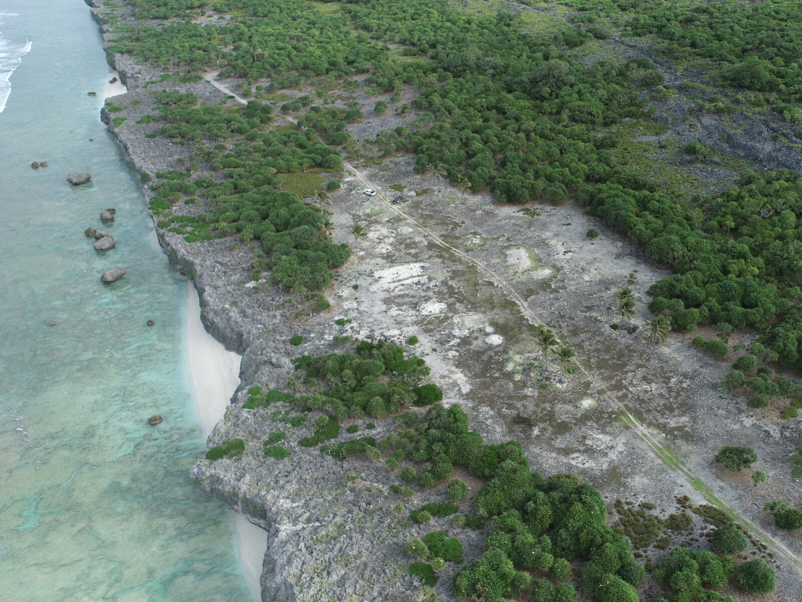
Explore more field evidence
A high-resolution drone orthomosaic and elevation model are available for HS115.
- Preserved framework with Porites-like groups and encrusters occurs near the seaward start of the transect.
- Cleared flats retain pits, sand, moved boulders, and large corals that appear in place.
- Mottled, recrystallized, and blue-black surfaces prompted competing vegetation, primary-fabric, fallen-block, and sea-cave-collapse interpretations.
Island 4 of 5
Mauke
Field records · June 5-8, 2026
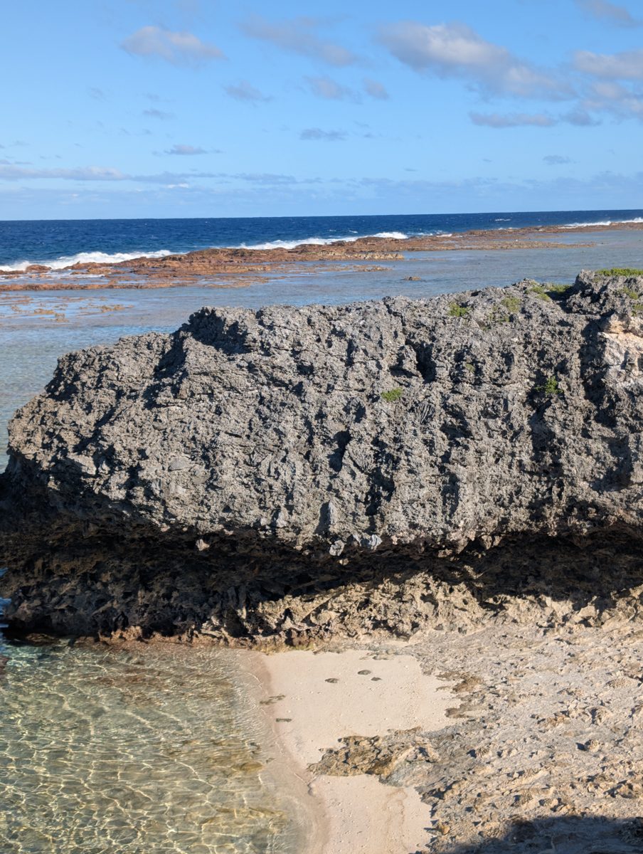
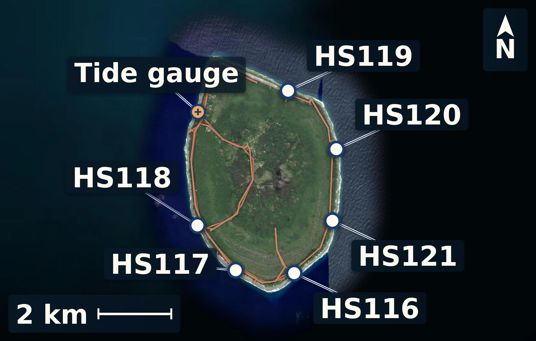
Mauke work focused on modern reef-flat observations, coastal sections, inland exposures, and published profile locations. After installing the harbor tide gauge, we began at Anaraura, where low coastal reef relations and samples required careful separation of in-place framework from rubble. The south-southwest section and Tukume added layered reef, Tridacna and coral samples, and higher limestone exposures. At Uriaata, raised spur-and-groove fabric, large Porites, modern reef-flat microatolls, and possible stranded boulders could be compared within one coastal setting. Arapaea revealed a notch-like feature, while Aanga supplied another comparison site. These sites span very different elevations, but height alone cannot show whether they formed at different sea levels. The working Mauke datum, growth-position checks, surface models, and coral ages will help separate original reef relief from later erosion, wave transport, clearing, and alteration in the raised reef limestone. Additionally, study of the modern reef and wave regimes will offer insight into the processes that shaped the raised reef and its preservation.
6 numbered sites 23 samples 5 surface models
6 numbered sites · 23 samples · 5 surface models
Height reference
Mauke tidal datum
Three days at the harbour
Working field reference
The harbour record establishes local mean sea level—our zero. Measured features are reported relative to this surface so the reef and shore can be compared on one scale.
working local datum · 12.53 m
- mean water above logger
- 0.50 m
- gauge tie
- 2.70 m
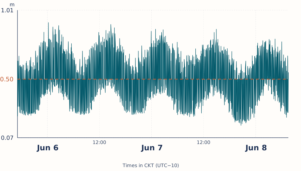
Whiskers show the field screening range, not a formal confidence interval.
The short, shallow deployment required island-specific screening.
Site records
Brief field views from Mauke
A few maps, photographs, and observations from surveyed sites.
HS116
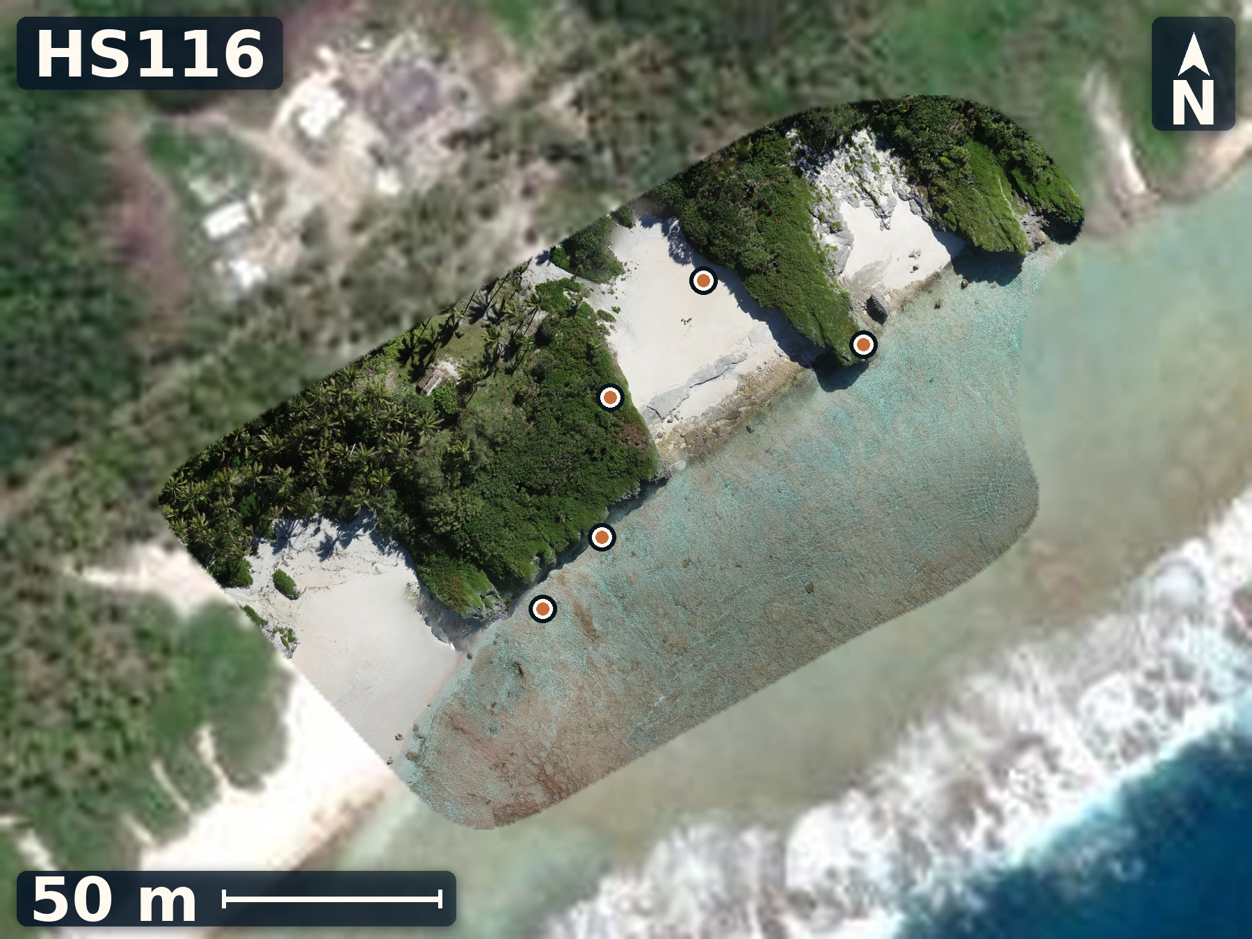
Anaraura
June 6, 2026
Anaraura combines a candidate two-unit exposure with dense photographic, sample, and mapped control, making growth position and height reconstruction testable.
Open QuestionDoes the irregular contact persist across spurs, and are its corals in growth position rather than groove rubble?
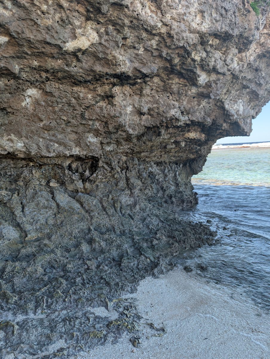
Explore more field evidence
A high-resolution drone orthomosaic and elevation model are available for HS116.
- Large coral spurs rise above grooves where accumulated rubble may obscure whether corals grew in place.
- A large Tridacna was observed on top of one coral spur.
- Small Porites-like colonies occur in the lower unit in front of the main spur.
HS117
South Southwest
June 6, 2026
South Southwest provides Mauke’s clearest comparison to HS116, testing whether coral growth created distinct reef units separated by an island-spanning surface.
Open QuestionAre HS117 corals securely in growth position above and below the irregular contact?
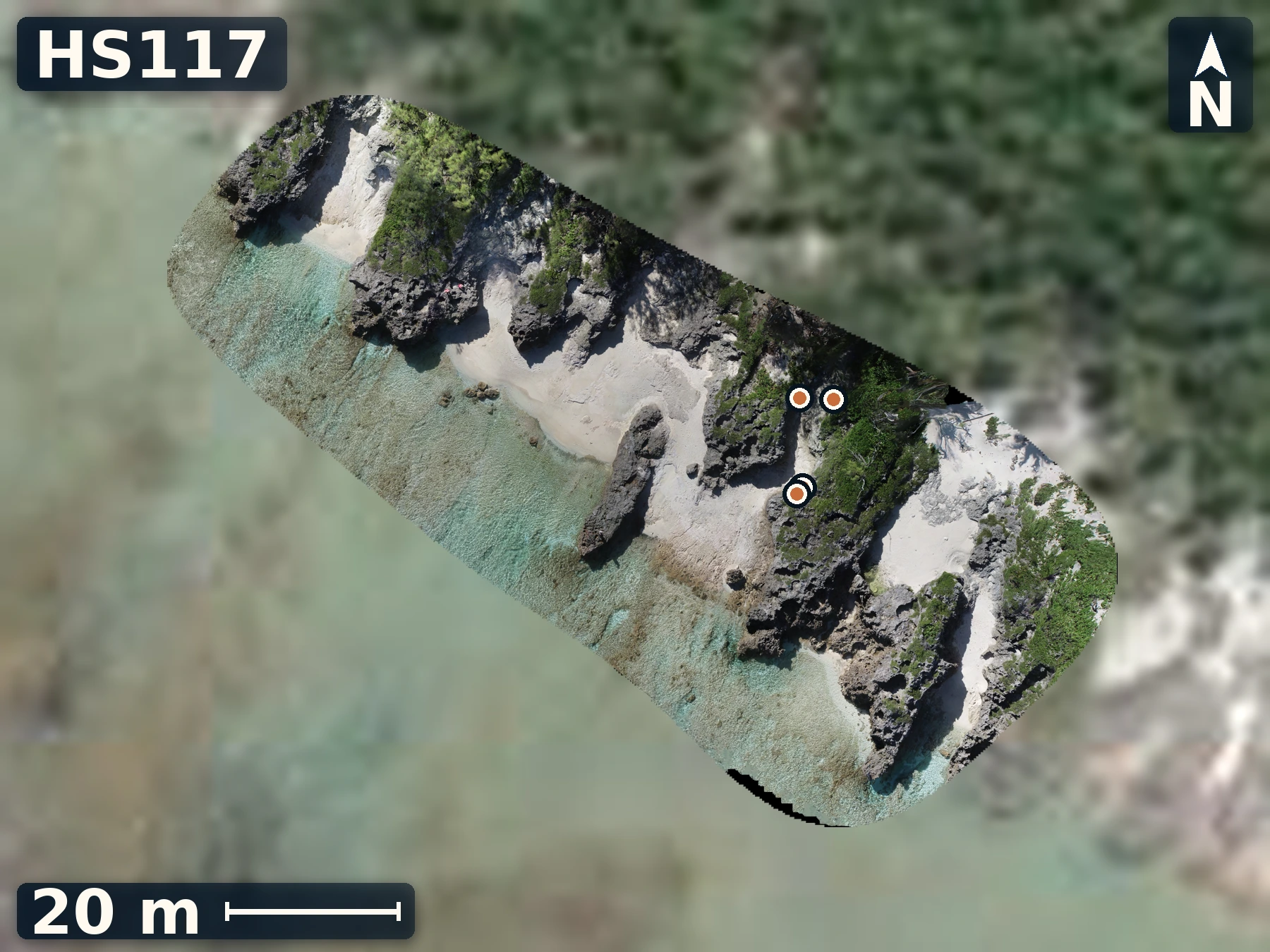
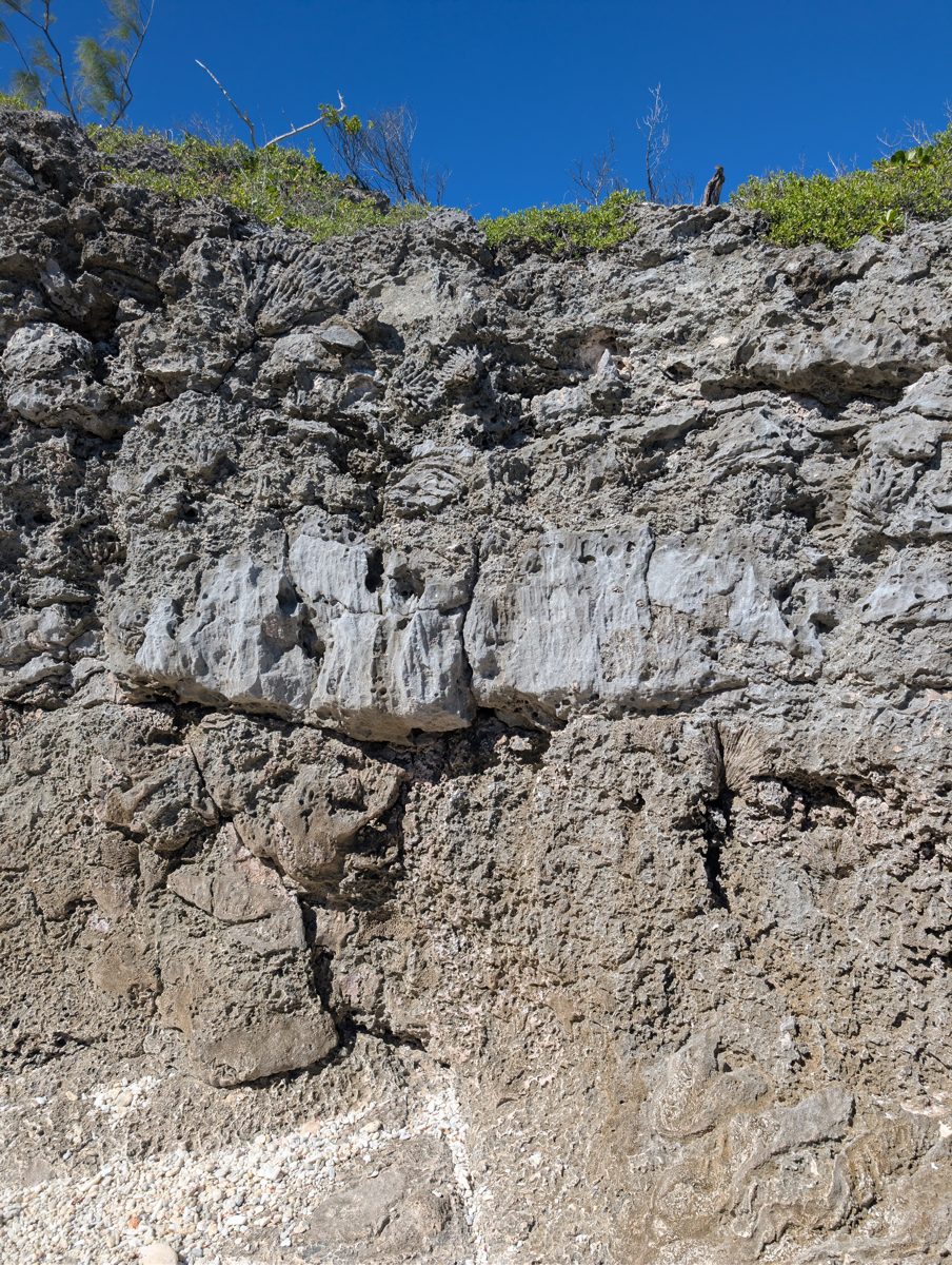
Explore more field evidence
A high-resolution drone orthomosaic and elevation model are available for HS117.
- Thinner vegetation makes the two-layer relation easier to see here than at HS116.
- A Tridacna and additional coral samples were documented at the site.
- The lower material may include both in-place colonies and rubble trapped against the wall.
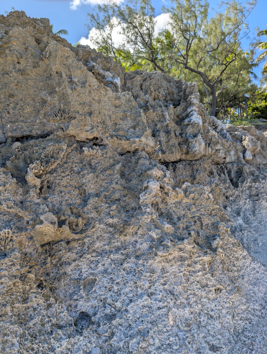
Field note · 13:30
Corals on the contact
The 13:30 field record describes corals growing directly on HS117’s irregular contact surface. The photograph preserves that relationship; whether colonies on either side are securely in growth position remains unresolved.
- 1Recorded contact surface
- 2Corals noted directly on it
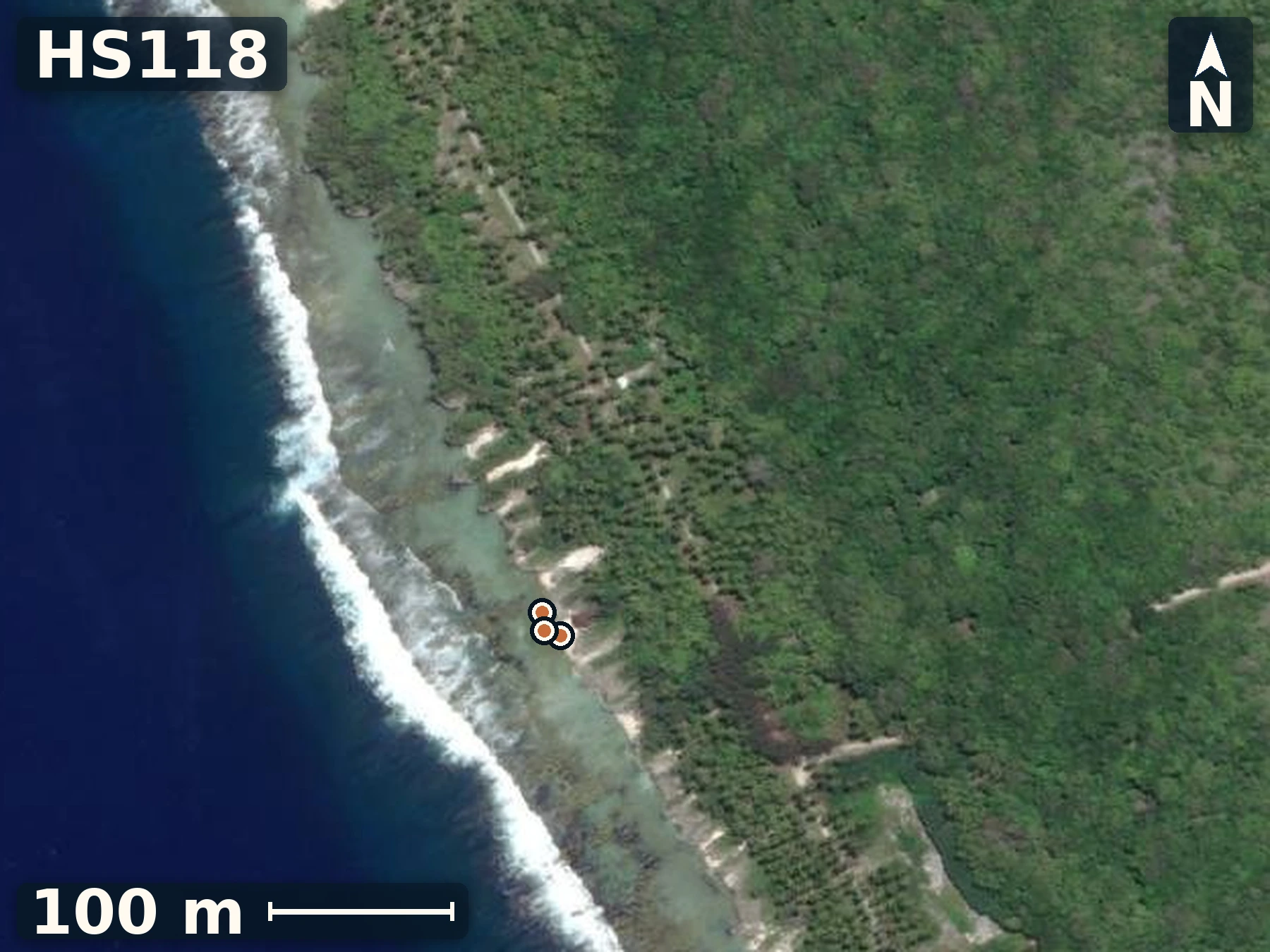
HS118
Tukume
June 6, 2026
Tukume extends the transect to the southwest, supplying another independent test of whether the layered relation continues along the coast.
Open QuestionDo corrected sample heights place Tukume’s possible horizons within the elevation range of other sites?
Explore more field evidence
A high-resolution surface model is not currently available for this site; satellite imagery, the mapped sample positions, and field photographs preserve its documented context.
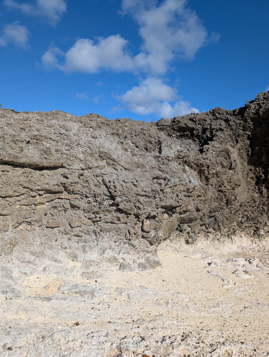
- Framework reef is present, but no contact matches the clarity of HS117.
- Two sampled corals were sighted roughly 1.3 m above nearby mapped reference points.
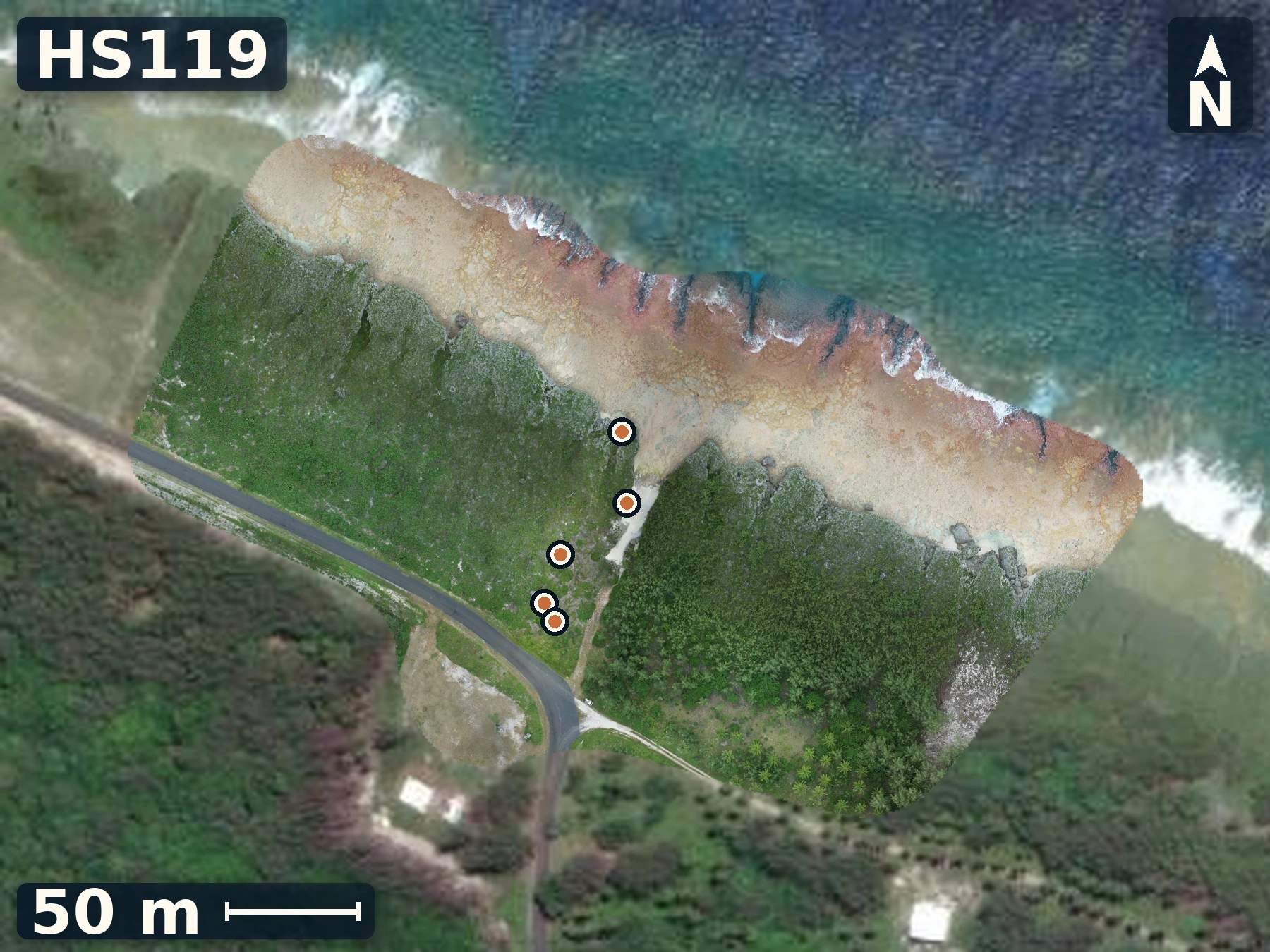
HS119
Uriaata
June 7, 2026
Uriaata connects a modern reef-flat, and a coastal elevated reef with some of the highest elevations on the island.
Open QuestionIs the coastal cliff and flat sequence temporally equivalent to the elevated inland coral up the road?
Explore more field evidence
A high-resolution drone orthomosaic and elevation model are available for HS119.
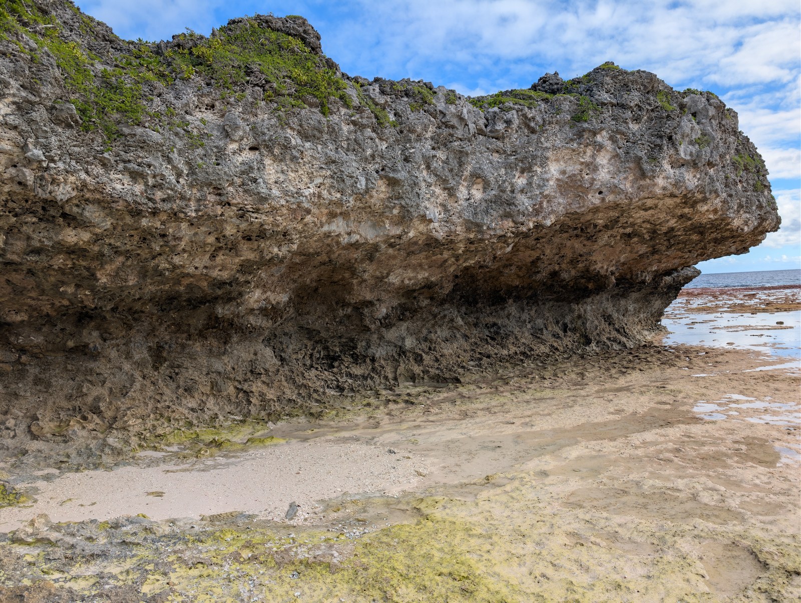
- The coastal spur is about 8 m high; higher outcrops upslope contain large corals described as in place.
- Modern microatolls occupy the lowest tidal pools beside the raised exposure.
- Reef-framework fabric continues inland beneath large trees, but becomes less obvious and may rise gradually.
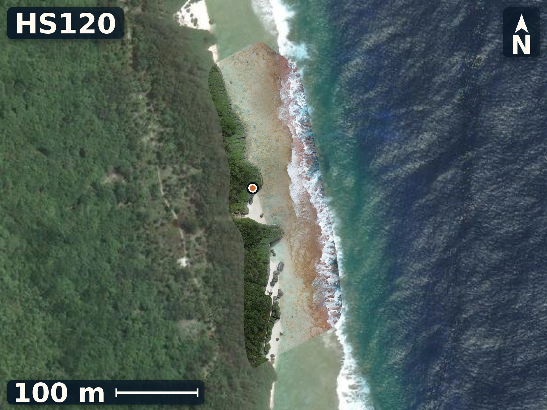
HS120
Arapaea
June 7, 2026
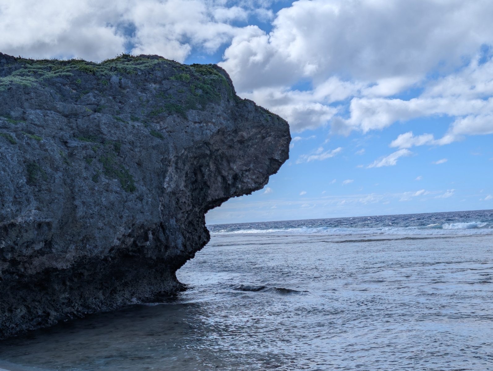
Arapaea suggests the layered pattern is regional and not island-spanning. The site also hosts a broad notch-like feature that may be from the early holocene.
Open QuestionDoes the broad recess follow one sloping surface or define a separate horizon once tied to the surface model?
Explore more field evidence
A high-resolution drone orthomosaic and elevation model are available for HS120.
- A broad recess descends gradually into the waterline rather than holding one clear level.
- Framework coral and a large Tridacna occur without an obvious second layer.
- Rubble beside a groove may record local channel fill rather than a regional boundary.
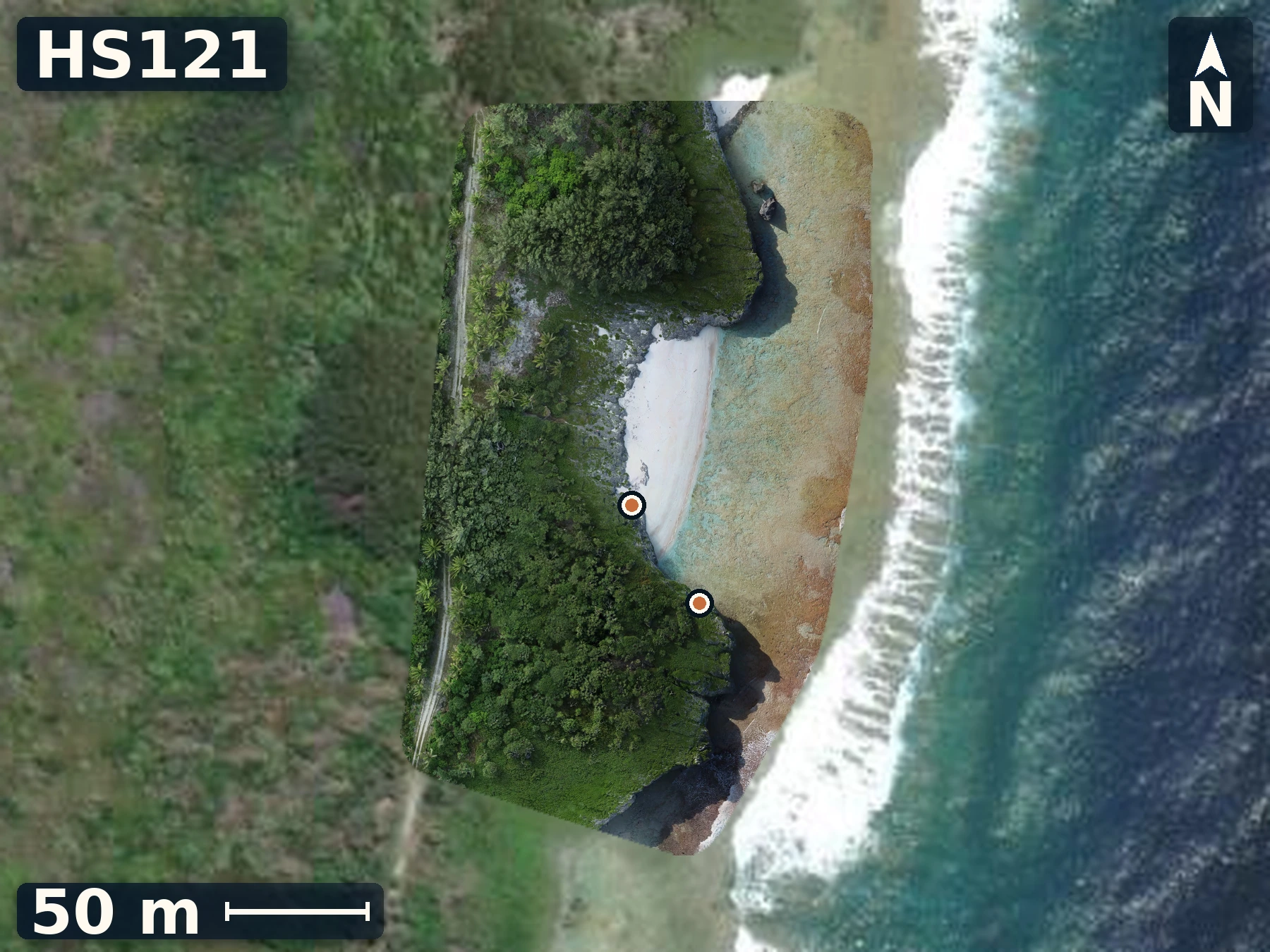
HS121
Aanga
June 7, 2026
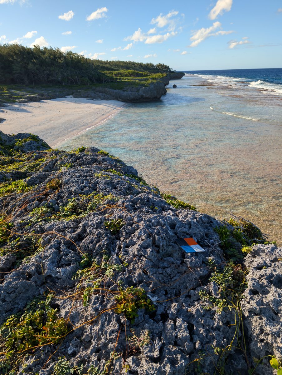
Aanga establishes mapped control at a previously published location, creating a measured target for comparing to the published section.
Open QuestionDo the HS121 reference points and exposure geometry align with the previously published Aanga profile?
Explore more field evidence
A high-resolution drone orthomosaic and elevation model are available for HS121.
- Five mapped reference points were recorded at the stop.
- The exact profile match remains unverified against the published map and field coordinates.
Island 5 of 5
Mitiaro
Field records · June 9-12, 2026
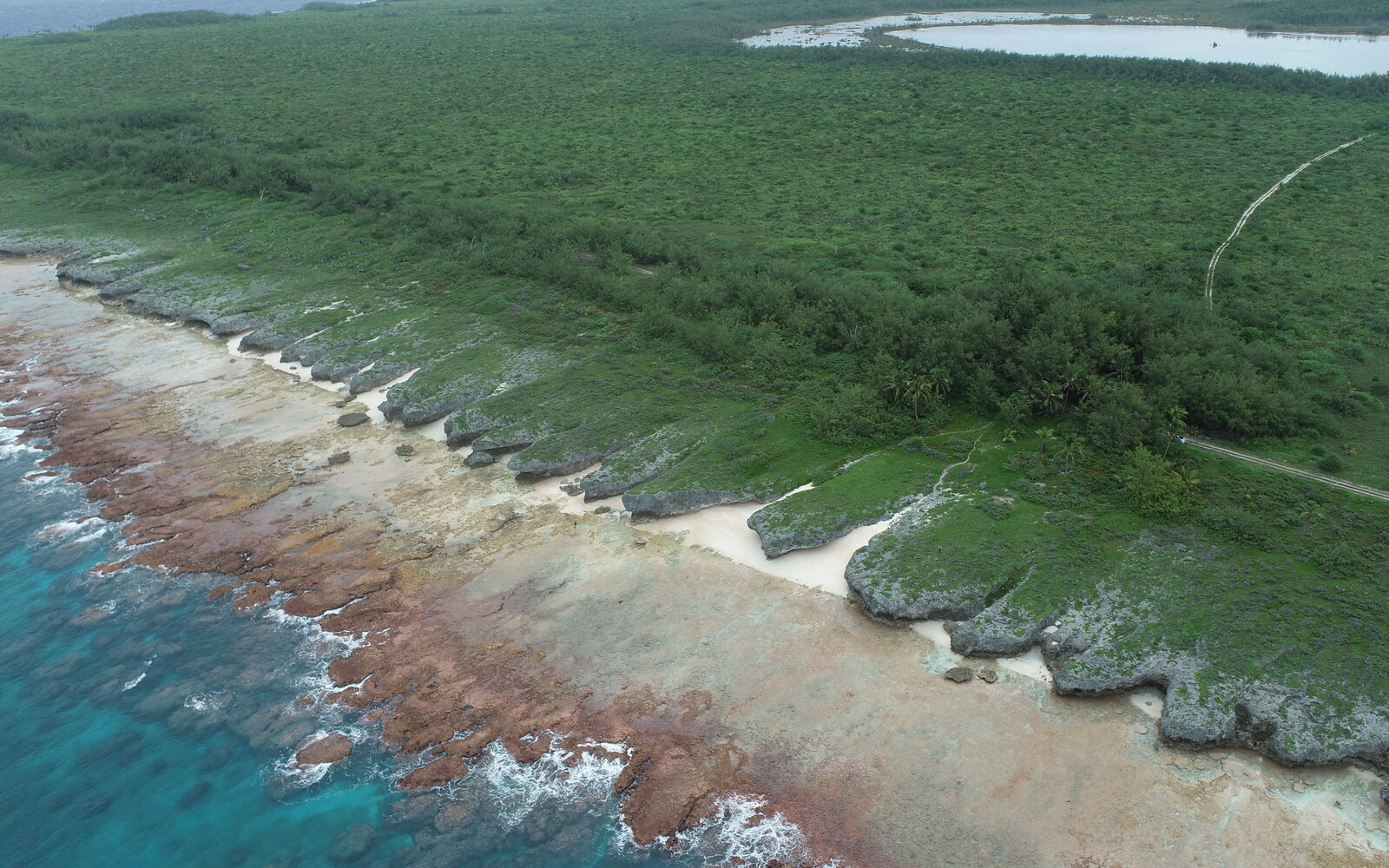
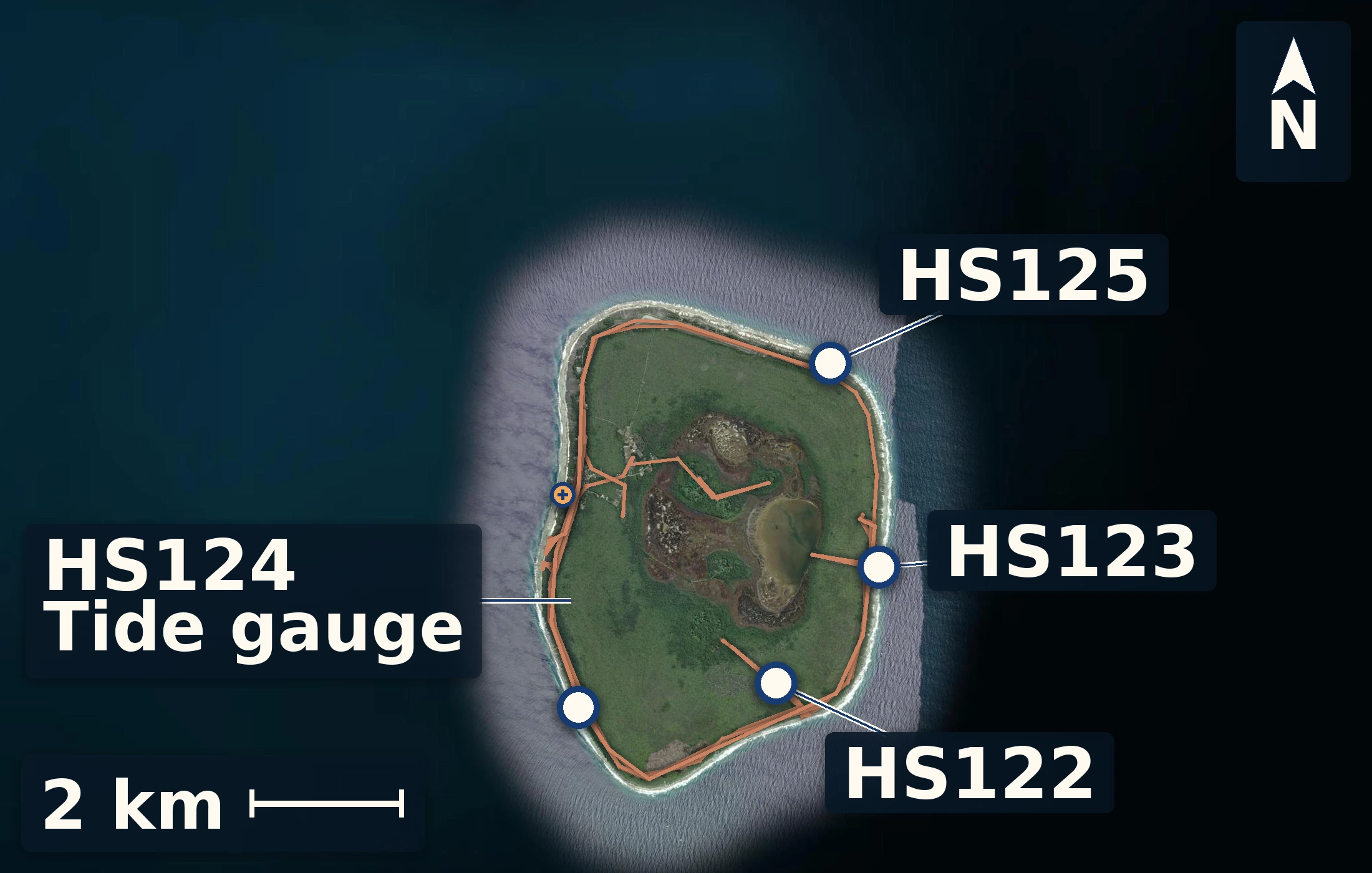
Mitiaro focused attention on the difficult boundary between younger coastal deposits and older reef limestone. A temporary harbor tide gauge provided a working island height reference before reconnaissance of weathered limestone and south-coast reddish outcrop. At Teunu, HS122 documented coral-bearing boulders, low ledges, reef-flat surfaces, vegetated pools, and seven samples whose transport and growth position still need checking. Te Rotonui, HS123, exposed coral-rich rock beneath an angular sand layer that may be perched-beach or storm-deposited material, together with possible younger tidal notch and coral fill closer to water level. Te Rua O Te Pui, HS124, recorded wind and wave setup across a modern reef flat and larger corals on spur tops. Okore, HS125, added broad backreef relief, lower spurs, a near-sea-level clast horizon, and mobile sand on the high-energy west coast. The datum, surface models, and future ages will test which features are young, which belong to older reefs, and how waves and preservation created the differences seen around the island.
4 numbered sites 23 samples 4 surface models
4 numbered sites · 23 samples · 4 surface models
Height reference
Mitiaro tidal datum
Three days at the harbour
Working field reference
The harbour record establishes local mean sea level—our zero. Measured features are reported relative to this surface so the reef and shore can be compared on one scale.
working local datum · 13.51 m
- mean water above logger
- 0.92 m
- gauge tie
- 1.91 m
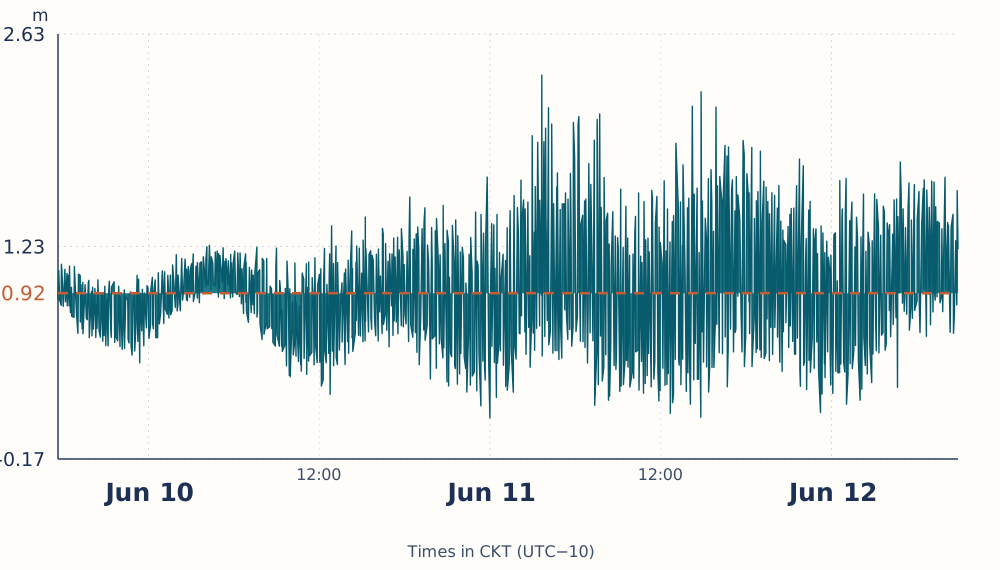
Whiskers show the field screening range, not a formal confidence interval.
Deployment and recovery measurements were screened together before calculating the working datum.
Site records
Brief field views from Mitiaro
A few maps, photographs, and observations from surveyed sites.
HS122
Teunu
June 9, 2026
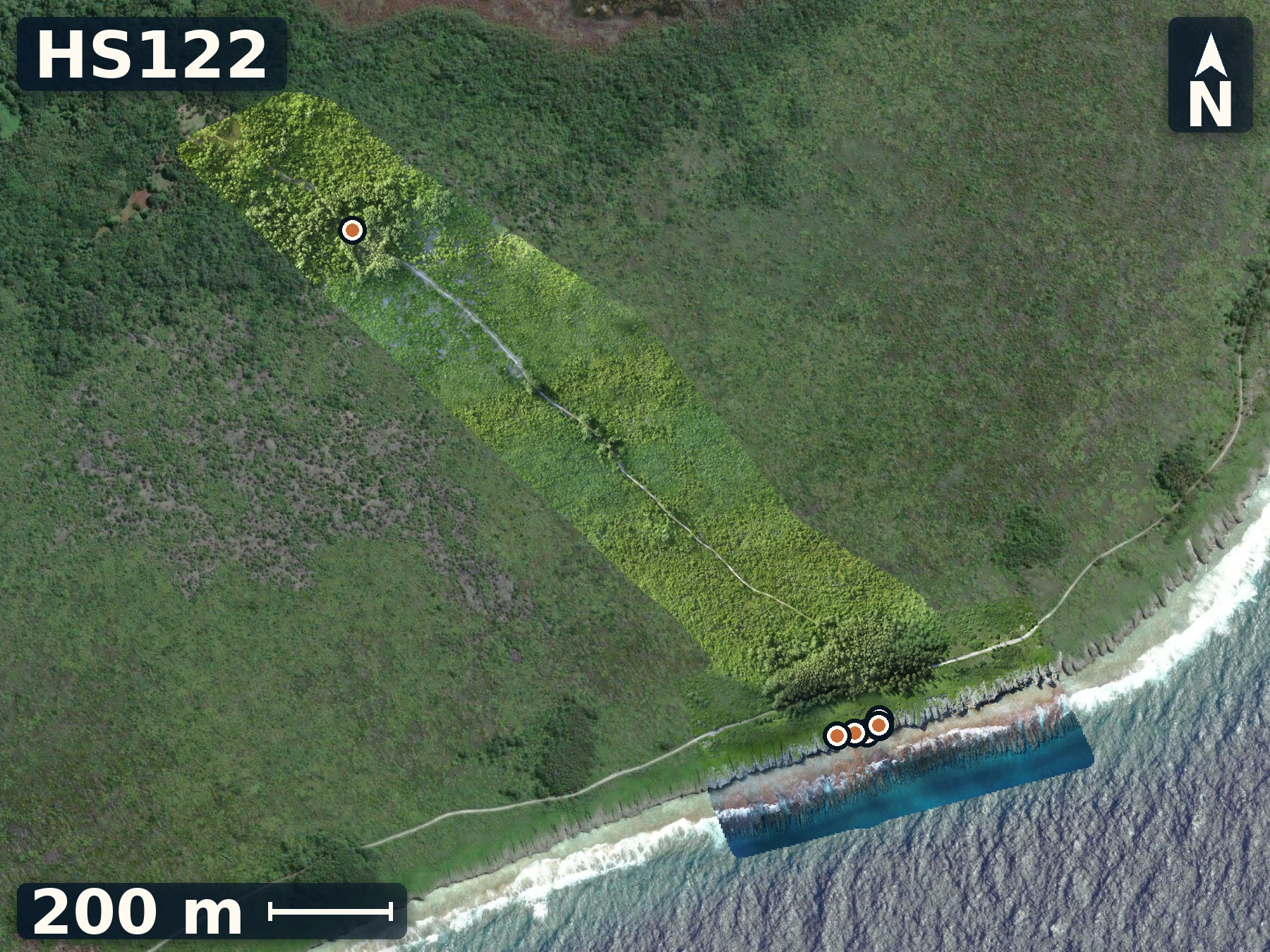
Teunu reveals how storm transport, reef-flat relief, and older limestone meet on Mitiaro’s exposed coast.
Open QuestionIs the highest mound weathering primary reef, or part of storm-reworked material?
Explore more field evidence
A high-resolution drone orthomosaic and elevation model are available for HS122.
- A near-constant ledge rims a vegetated low; pool erosion, inherited relief, and overwash ponding remain alternatives.
- Ledge photos show blocky microcrystalline carbonate with lighter platy or elongate fabric.
- A recently overturned storm block exposed fresh white rock where the team sampled the outcrop.
HS123
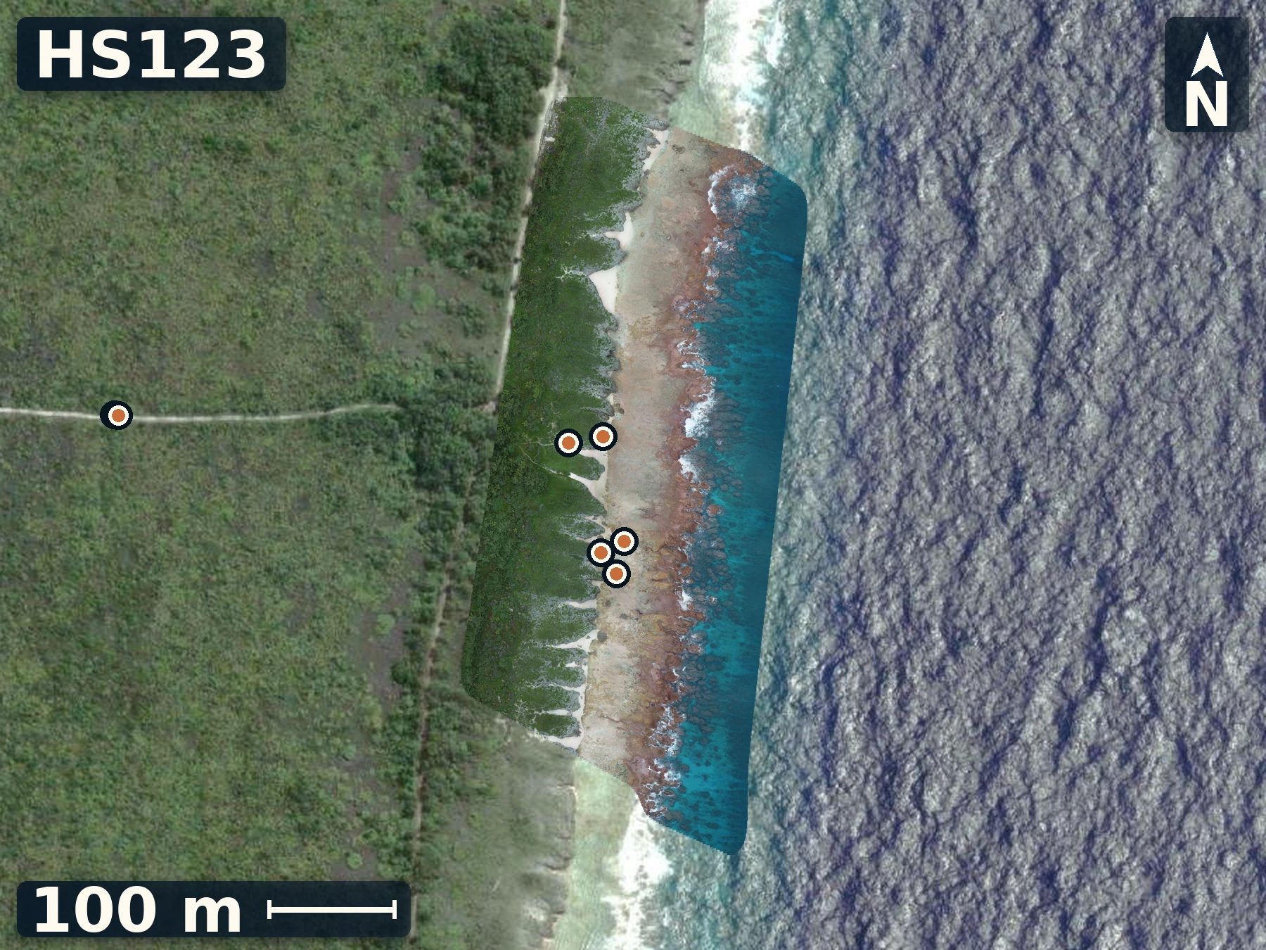
Te Rotonui
June 10, 2026
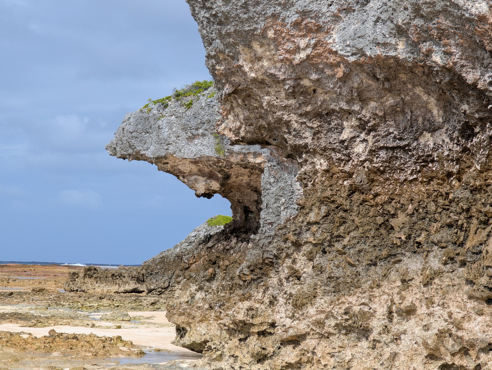
Te Rotonui exposes possible younger notch fill against older reef rock, and has abundant cross-cutting cracks that can mimic geologic surfaces.
Open QuestionWhich fabric, mineralogy, and elevation criteria can distinguish younger notch fill from older wall rock at HS123?
Explore more field evidence
A high-resolution drone orthomosaic and elevation model are available for HS123.
- Corals within and near the notch may be younger fill, but separation from older wall rock remains unresolved.
- Horizontal cracks cut through large coral colonies, so they cannot automatically be treated as exposure surfaces.
- Rocky highs beside the road may be local patch-reef relief rather than a continuous surface.
HS124
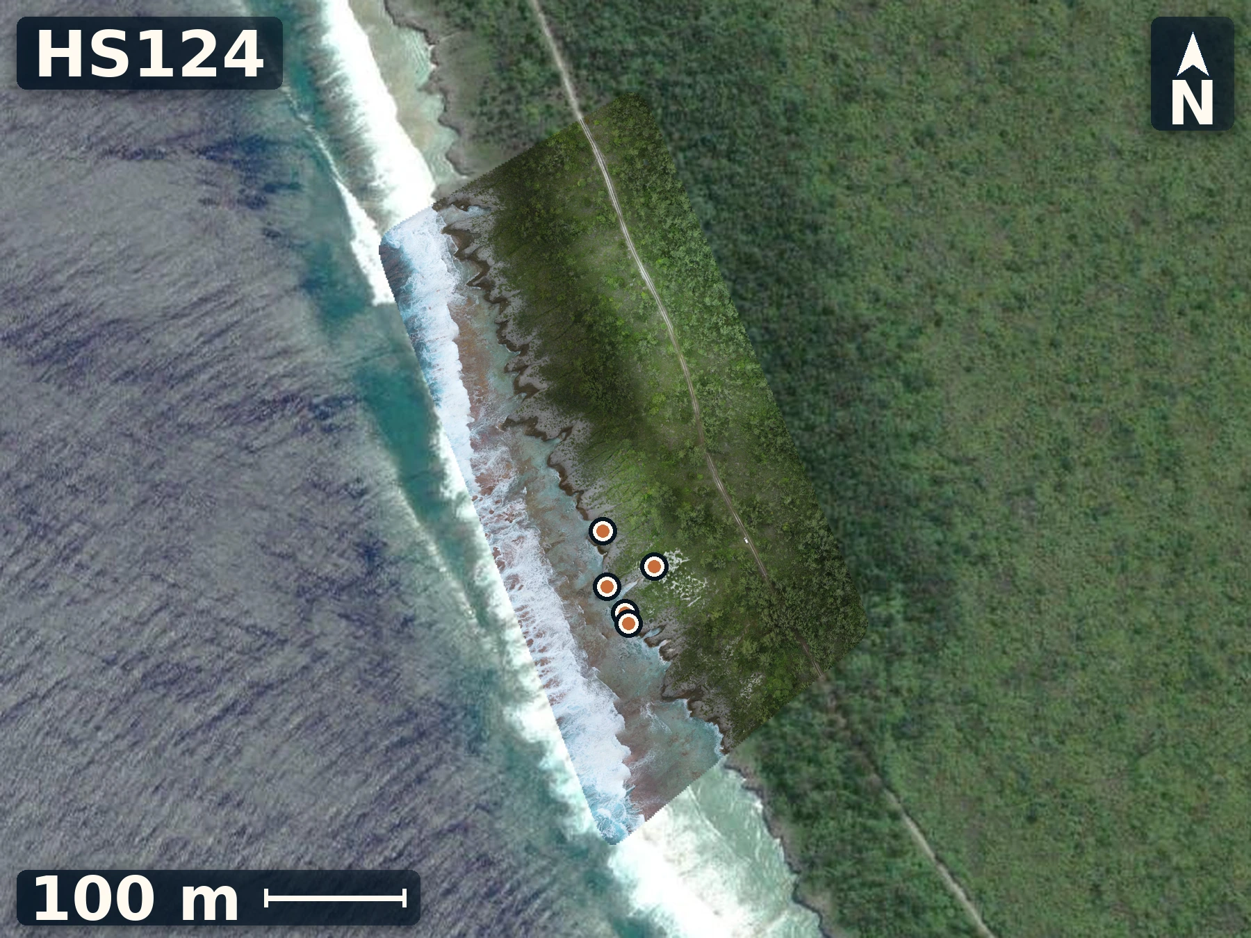
Te Rua O Te Pui
June 10, 2026
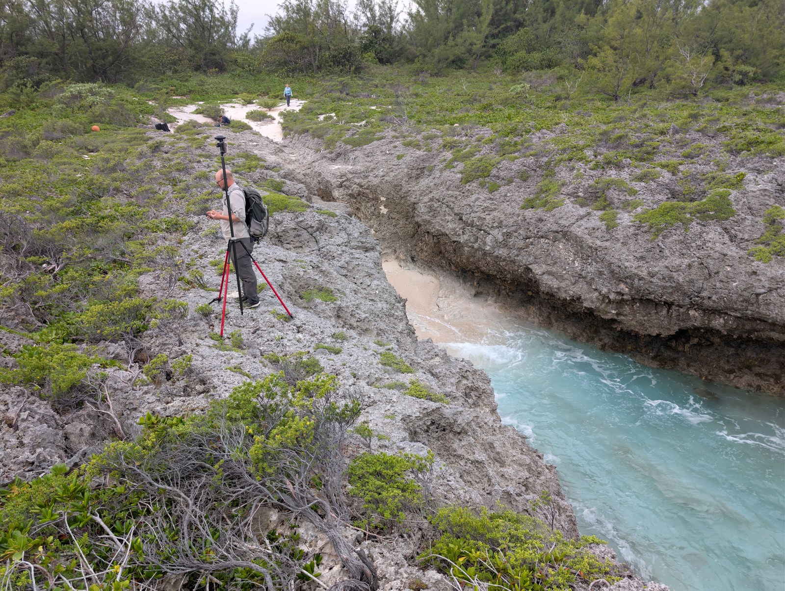
Te Rua O Te Pui offers clear exposure of a southwest facing reef with spurs and grooves that appear primary.
Open QuestionDoes the spacing and relief of Te Rua O Te Pui’s spurs and grooves tell us anything about the paleo-environment?
Explore more field evidence
A high-resolution drone orthomosaic and elevation model are available for HS124.
- Larger coral colonies occupied spur tops, distinct from the morning stop.
- Rock surfaces were sharper and more micro-rough than at earlier Mitiaro stops.
- Two mapped reference points were recorded near the end of the day.
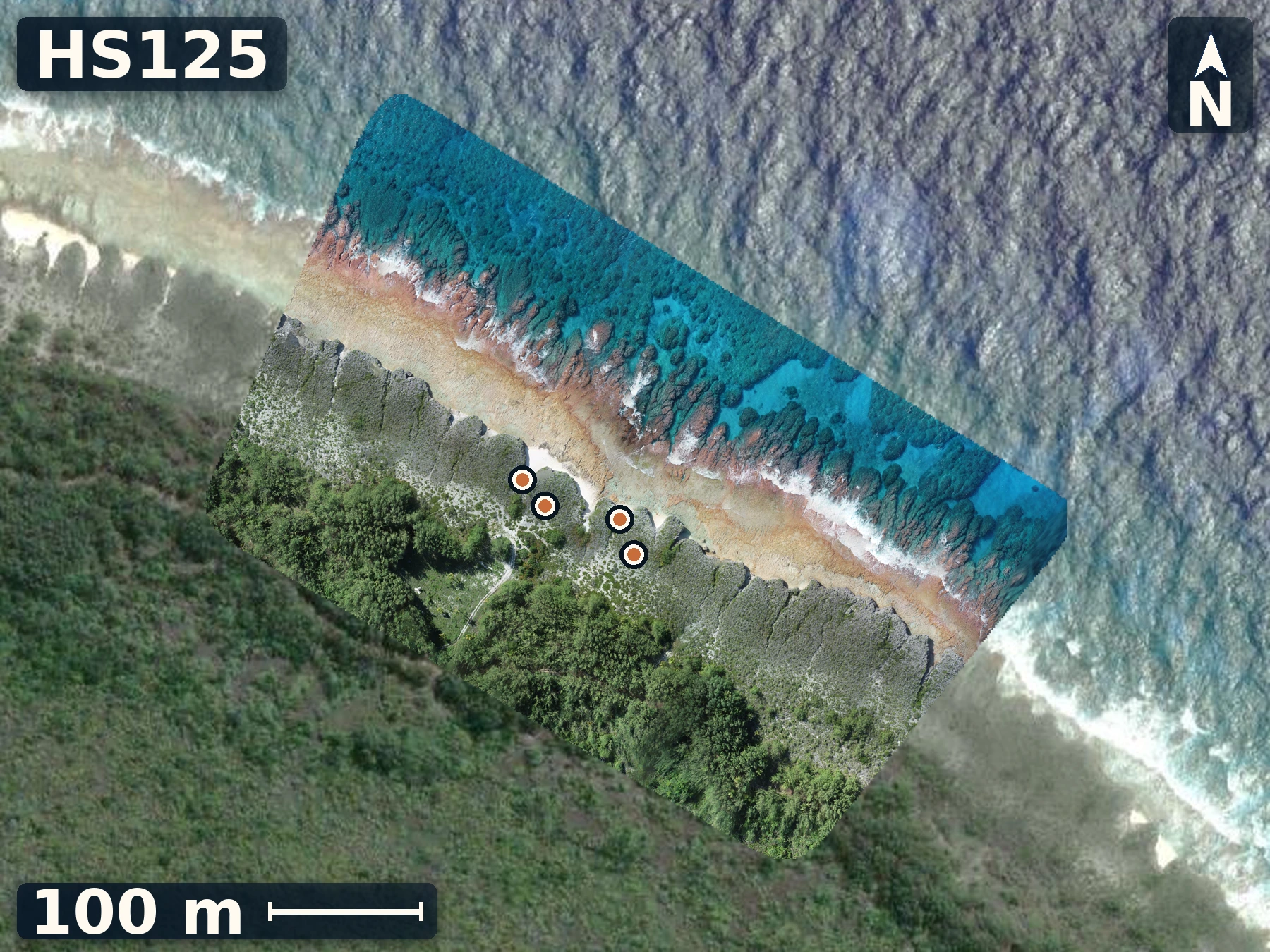
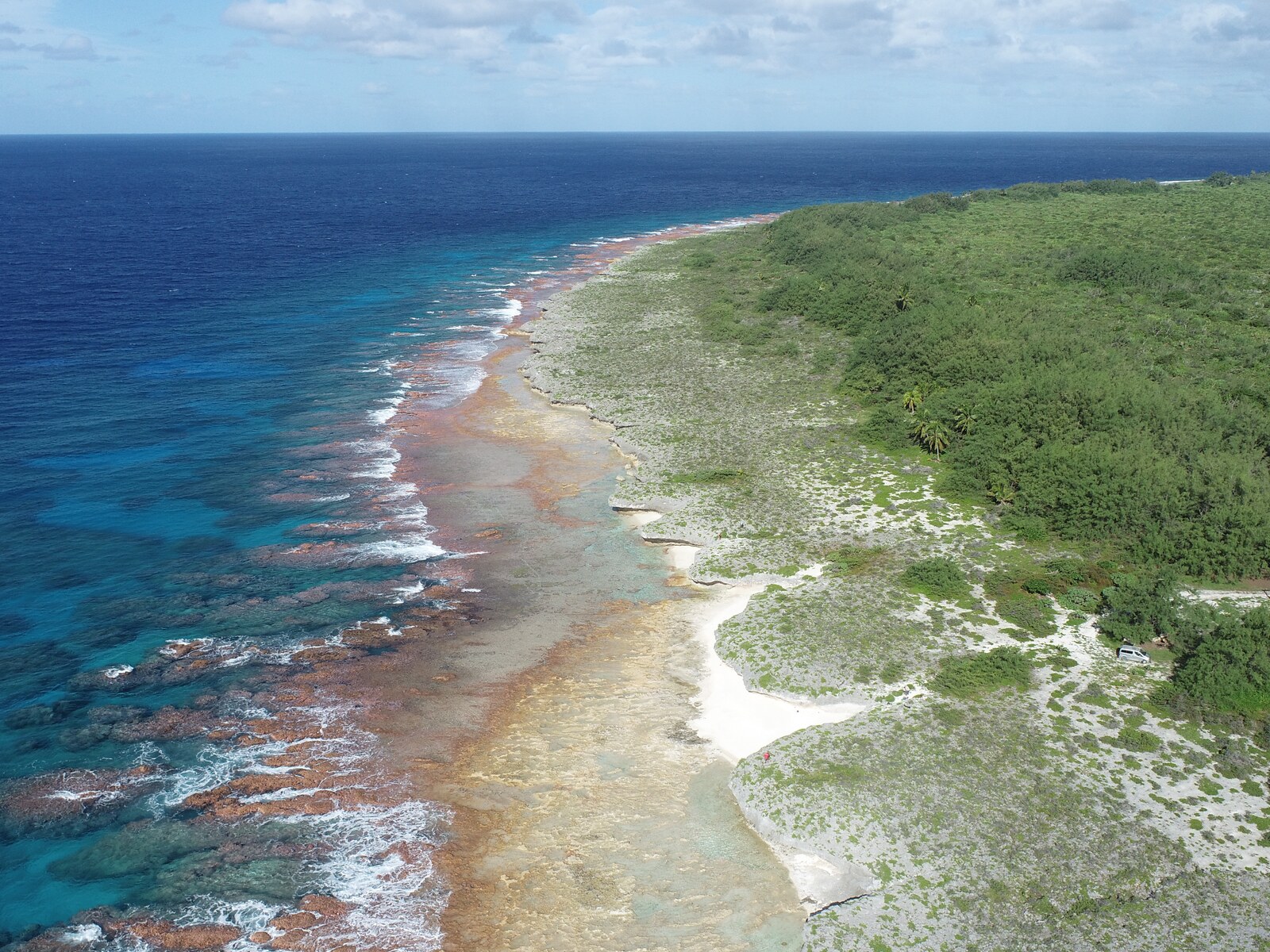
HS125
Okore
June 11, 2026
Okore has a near-sea-level clast horizon whose weathering differs from overlying rock, offering a focused test of storm emplacement versus older reef fabric versus early holocene highstand.
Open QuestionIs the groove’s clast horizon storm-emplaced material, in-place reef, or weathered older limestone?
Explore more field evidence
A high-resolution drone orthomosaic and elevation model are available for HS125.
- The clast horizon occurs within a groove close to modern sea level.
- Its weathering differs from the material above it.
- Four mapped reference points document the stop.
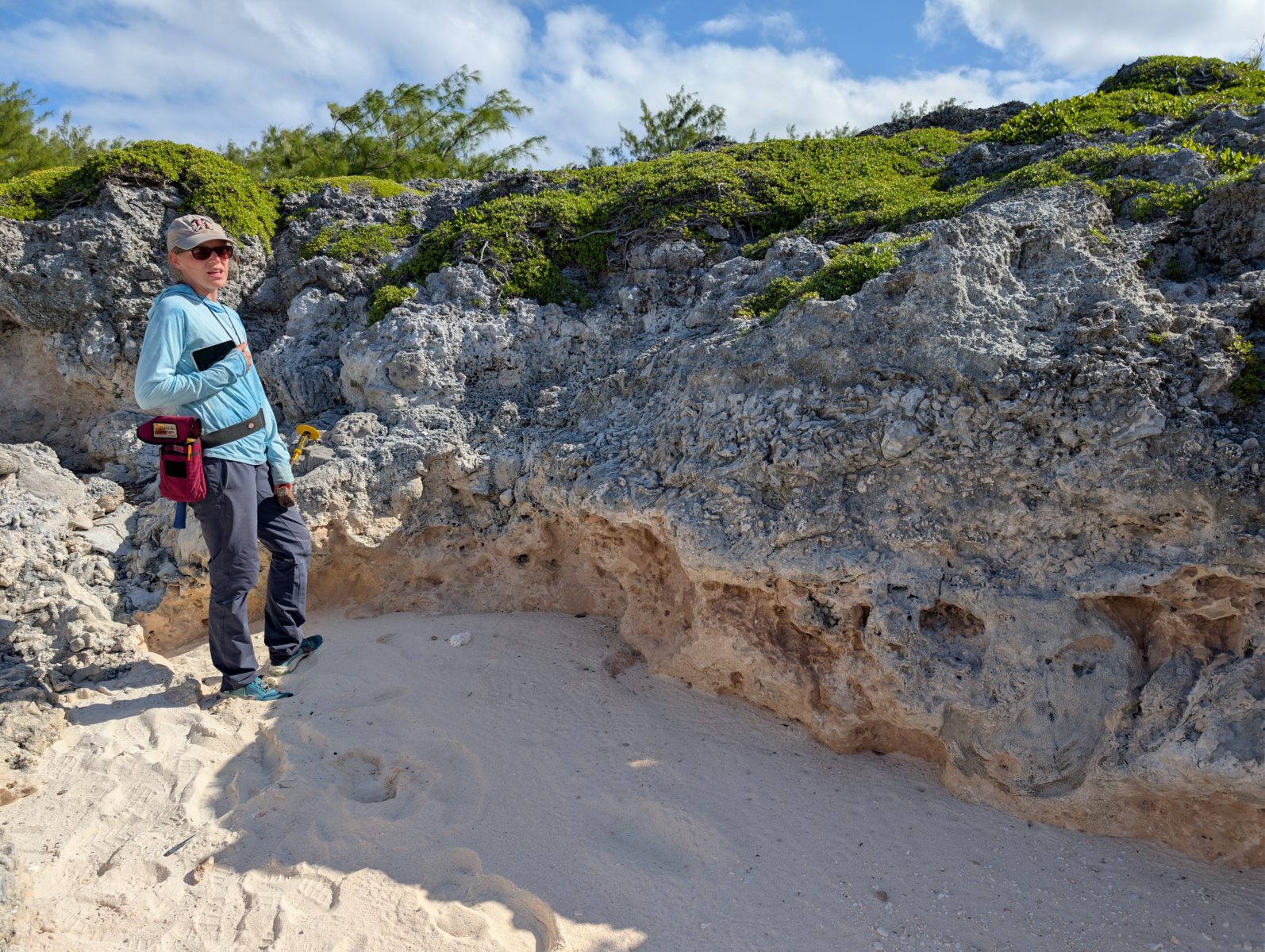
Field note · 14:51
A clast-rich band in the groove
Photographed is a distinct clast-rich band beside Jacky, close to modern sea level, where the rock weathers differently from material above. Whether it is storm-emplaced material, in-place reef, or weathered older limestone remains unresolved.
- 1Clast-rich band
- 2Differently weathered rock above
Next research
Three planned research papers for the next phase
- Paper 1
Reef morphology, elevation, waves, and sea level
Compare site elevation and morphology within and among islands using digital elevation models (DEMs), orthomosaics, tidal datums, field fabric, and modern analogues. Test which combinations of wave exposure, reef setting, relative sea level, erosion, transport, and preservation can explain each site.
- Paper 2
Why relative sea level differs between islands
Use dated reef indicators and corrected heights to test contributions from volcanic loading, lithospheric flexure, volcanic swells, and glacial isostatic adjustment while separating these signals from reef ecology, preservation, age, and measurement uncertainty.
- Paper 3
Geochronology, coral preservation, and makatea formation
Date the sites, document how coral preservation changes with time and environment, and constrain when the raised reef units formed. Last Interglacial ages and elevations can improve constraints on polar ice in a warmer world and, through appropriate models, inform future local sea-level projections.
Sources that frame the interpretation
- Stoddart et al. (1990)Describes makatea morphology, elevations, reef units, and storm-boulder cautions on Atiu, Mauke, and Mitiaro.
- Woodroffe et al. (1991)Provides dated Southern Cook Islands reef evidence and shows why growth position, preservation, age, and height must be interpreted together.
- Huppert et al. (2015)Supplies a Hawaiian volcanic-loading and flexure mechanism analogue, not a Cook Islands calibration.
- Du et al. (2026)Constrains the ages and geometry of Tama and Rarotonga volcanism while leaving the longer hotspot history unresolved.
Field glossary
A short field glossary
- Raised reef limestone (makatea)
- Old coral reef and reef sediment that now stand above the living shore.
- Reef flat
- A shallow, wave-washed surface where corals, algae, shells, and sediment occur near sea level.
- Microatoll
- A coral colony whose upper surface stops growing where repeated low-water exposure limits growth while its outer edge continues outward.
- Coral framework
- Reef rock that preserves corals and other builders where they grew, rather than as loose transported rubble.
- Orthomosaic
- A map-like image assembled from many overlapping drone photographs.
- Digital elevation model
- A high-resolution map of the height and shape of the ground or reef surface.
- U-Th dating
- A laboratory method that estimates coral age from uranium and thorium isotopes.
- Tidal datum
- A local sea-level reference used to compare elevations measured on different days and islands.